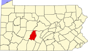
Census-designated place in Pennsylvania, United States
| Elberta, Pennsylvania | |
|---|---|
| Census-designated place | |
  | |
| Coordinates: 40°30′45″N 78°19′27″W / 40.51250°N 78.32417°W / 40.51250; -78.32417 | |
| Country | United States |
| State | Pennsylvania |
| County | Blair |
| Township | Tyrone |
| Area | |
| • Total | 0.63 sq mi (1.63 km) |
| • Land | 0.63 sq mi (1.63 km) |
| • Water | 0.00 sq mi (0.00 km) |
| Elevation | 1,765 ft (538 m) |
| Population | |
| • Total | 271 |
| • Density | 430.84/sq mi (166.46/km) |
| Time zone | UTC-5 (Eastern (EST)) |
| • Summer (DST) | UTC-4 (EDT) |
| ZIP Code | 16601 (Altoona) |
| Area code(s) | 814/582 |
| FIPS code | 42-22776 |
| GNIS feature ID | 2805492 |
Elberta is an unincorporated community and census-designated place (CDP) in Blair County, Pennsylvania, United States. It was first listed as a CDP prior to the 2020 census.
Geography
| This section does not cite any sources. Please help improve this section by adding citations to reliable sources. Unsourced material may be challenged and removed. Find sources: "Elberta, Pennsylvania" – news · newspapers · books · scholar · JSTOR (August 2024) (Learn how and when to remove this message) |
The CDP is in central Blair County, in the southern end of Tyrone Township. It is at the headwaters of Sinking Run, in a valley between two arms of Brush Mountain. Sinking Run flows northeast into Sinking Valley and joins the Little Juniata River at the northeastern end of Tyrone Township.
Kettle Road is the only through road in Elberta. It leads west through the Kettle Creek water gap in Brush Mountain 4 miles (6 km) to Altoona, while to the northeast it leads 11 miles (18 km) through Sinking Valley to Pennsylvania Route 453.
Demographics
| Census | Pop. | Note | %± |
|---|---|---|---|
| 2020 | 271 | — | |
| U.S. Decennial Census | |||
Education
The school district is Altoona Area School District. Altoona Area High School is the comprehensive high school.
References
- "ArcGIS REST Services Directory". United States Census Bureau. Retrieved October 12, 2022.
- ^ U.S. Geological Survey Geographic Names Information System: Elberta, Pennsylvania
- "Census Population API". United States Census Bureau. Retrieved October 12, 2022.
- "Census of Population and Housing". Census.gov. Retrieved June 4, 2016.
- "2020 CENSUS - SCHOOL DISTRICT REFERENCE MAP: Blair County, PA" (PDF). U.S. Census Bureau. Retrieved December 22, 2024. - Text list
This Blair County, Pennsylvania state location article is a stub. You can help Misplaced Pages by expanding it. |
