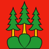
| Emmental District Verwaltungskreis Emmental | |
|---|---|
| District | |
 Flag Flag Coat of arms Coat of arms | |
| Country | |
| Canton | |
| Capital | Langnau im Emmental |
| Area | |
| • Total | 691 km (267 sq mi) |
| Population | |
| • Total | 97,666 |
| • Density | 140/km (370/sq mi) |
| Time zone | UTC+1 (CET) |
| • Summer (DST) | UTC+2 (CEST) |
| Municipalities | 39 |
Emmental District in the Canton of Bern was created on 1 January 2010. It is part of the Emmental-Oberaargau administrative region. It contains 40 municipalities with an area of 690.45 km (266.58 sq mi) and a population (as of 31 December 2020) of 97,666.
| Flag | Name | Population (31 December 2020) |
Area in km² |
|---|---|---|---|
| Aefligen | 1,103 | 2.03 | |
| Affoltern im Emmental | 1,125 | 11.49 | |
| Alchenstorf | 584 | 6.56 | |
| Bätterkinden | 3,288 | 10.17 | |
| Burgdorf | 16,583 | 15.61 | |
| Dürrenroth | 1,052 | 14.13 | |
| Eggiwil | 2,486 | 60.32 | |
| Ersigen | 2,063 | 8.73 | |
| Hasle bei Burgdorf | 3,302 | 21.90 | |
| Heimiswil | 1,632 | 23.34 | |
| Hellsau | 214 | 1.49 | |
| Hindelbank | 2,519 | 9.7 | |
| Höchstetten | 279 | 2.63 | |
| Kernenried | 547 | 3.34 | |
| Kirchberg | 5,919 | 9.02 | |
| Koppigen | 2,104 | 6.93 | |
| Krauchthal | 2,384 | 19.43 | |
| Langnau im Emmental | 9,262 | 48.39 | |
| Lauperswil | 2,663 | 21.22 | |
| Lützelflüh | 4,211 | 26.92 | |
| Lyssach | 1,466 | 6.06 | |
| Oberburg | 2,937 | 14.11 | |
| Röthenbach im Emmental | 1,169 | 36.78 | |
| Rüderswil | 2,373 | 17.15 | |
| Rüdtligen-Alchenflüh | 2,444 | 2.74 | |
| Rüegsau | 3,265 | 15.10 | |
| Rumendingen | 81 | 2.42 | |
| Rüti bei Lyssach | 172 | 1.30 | |
| Schangnau | 918 | 36.48 | |
| Signau | 2,594 | 22.10 | |
| Sumiswald | 5,044 | 59.37 | |
| Trachselwald | 954 | 15.95 | |
| Trub | 1,314 | 62.02 | |
| Trubschachen | 1,465 | 15.63 | |
| Utzenstorf | 4,430 | 16.94 | |
| Wiler bei Utzenstorf | 995 | 3.83 | |
| Willadingen | 199 | 2.16 | |
| Wynigen | 2,077 | 28.31 | |
| Zielebach | 330 | 1.92 | |
| Total (40) | 97,666 | 690.45 |
Mergers and name changes
- On 1 January 2016, the former municipalities of Oberösch and Niederösch merged into Ersigen.
- On 1 January 2021 the former municipality of Mötschwil merged into Hindelbank.
References
- Amtliches Gemeindeverzeichnis der Schweiz, Mutationsmeldungen 2009 / Répertoire officiel des communes de Suisse, Mutations 2009 / Elenco ufficiale dei Comuni della Svizzera, Mutazione 2009 (PDF) (Report). Federal Statistical Office. 2009. 2776. Archived from the original (PDF) on 18 November 2010. Retrieved 6 March 2010.
- ^ "Ständige und nichtständige Wohnbevölkerung nach institutionellen Gliederungen, Geburtsort und Staatsangehörigkeit". bfs.admin.ch (in German). Swiss Federal Statistical Office - STAT-TAB. 31 December 2020. Retrieved 21 September 2021.
- Arealstatistik Standard - Gemeindedaten nach 4 Hauptbereichen
- Nomenklaturen – Amtliches Gemeindeverzeichnis der Schweiz Archived 2015-11-13 at the Wayback Machine (in German) accessed 3 February 2016
- "Applikation der Schweizer Gemeinden". bfs.admin.ch. Swiss Federal Statistical Office. 2021. Retrieved 26 January 2021.
| Regions | |
|---|---|
| Districts | |
46°56′N 7°47′E / 46.933°N 7.783°E / 46.933; 7.783
Category: