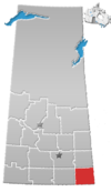
Village in Saskatchewan, Canada
| Forget | |
|---|---|
| Village | |
| Village of Forget | |
 Our Lady of La Salette Church in Forget Our Lady of La Salette Church in Forget | |
  | |
| Coordinates: 49°39′13″N 102°52′12″W / 49.65361°N 102.87000°W / 49.65361; -102.87000 | |
| Country | Canada |
| Province | Saskatchewan |
| Census division | 1 |
| Rural Municipality | Tecumseh |
| Government | |
| • Type | Municipal |
| • Governing body | Forget Village Council |
| • Mayor | Rick Coderre |
| • Administrator | Zandra Slater |
| Area | |
| • Total | 1.39 km (0.54 sq mi) |
| Population | |
| • Total | 55 |
| • Density | 39.7/km (103/sq mi) |
| Time zone | UTC-6 (CST) |
| Postal code | S0C 0X0 |
| Area code | 306 |
| Highways | |
| Railways | Canadian Pacific Railway |
Forget /ˈfɔːrʒeɪ/ is a village in the Canadian province of Saskatchewan within the Rural Municipality of Tecumseh No. 65 and Census Division No. 1. It is located east of Stoughton, near Highway 13.
Forget incorporated as a village on November 21, 1904. The village is named in honour of Amédée E. Forget, the first Lieutenant Governor of Saskatchewan.
Demographics
| Year | Pop. | ±% |
|---|---|---|
| 1981 | 70 | — |
| 1986 | 81 | +15.7% |
| 1991 | 68 | −16.0% |
| 1996 | 62 | −8.8% |
| 2001 | 40 | −35.5% |
| 2006 | 40 | +0.0% |
| 2011 | 35 | −12.5% |
| 2016 | 55 | +57.1% |
| 2021 | 35 | −36.4% |
| Source: Statistics Canada via Saskatchewan Bureau of Statistics | ||
In the 2021 Census of Population conducted by Statistics Canada, Forget had a population of 35 people living in 18 of its 22 total private dwellings. With a land area of 1.37 km (0.53 sq mi), it had a population density of 25.5/km (66.2/sq mi) in 2021.
See also
References
- National Archives, Archivia Net, Post Offices and Postmasters, archived from the original on 6 October 2006
- Government of Saskatchewan, MRD Home, Municipal Directory System, archived from the original on 21 November 2008
- Canadian Textiles Institute. (2005), CTI Determine your provincial constituency, archived from the original on 11 September 2007
- Commissioner of Canada Elections, Chief Electoral Officer of Canada (2005), Elections Canada On-line, archived from the original on 21 April 2007
- The Canadian Press (2017), The Canadian Press Stylebook (18th ed.), Toronto: The Canadian Press
- "Urban Municipality Incorporations". Saskatchewan Ministry of Government Relations. Archived from the original on 15 October 2014. Retrieved 1 June 2020.
- "Saskatchewan Census Population" (PDF). Saskatchewan Bureau of Statistics. Archived from the original (PDF) on 24 September 2015. Retrieved 31 May 2020.
- "Saskatchewan Census Population". Saskatchewan Bureau of Statistics. Retrieved 31 May 2020.
- "Population and dwelling counts, for Canada, provinces and territories, and census subdivisions (municipalities), 2016 and 2011 censuses – 100% data (Saskatchewan)". Statistics Canada. 8 February 2017. Retrieved 30 May 2020.
- ^ "Population and dwelling counts: Canada, provinces and territories, census divisions and census subdivisions (municipalities), Saskatchewan". Statistics Canada. 9 February 2022. Retrieved 1 April 2022.

Further reading
- Abley, Mark (1986) Beyond Forget: Rediscovering the Prairies, Canada: Douglas & McIntyre Ltd., reprinted 1988 by Chatto & Windus Ltd., London, UK, ISBN 0-7011-3296-5. Pages 10–14 focus on Forget and its hotel.
| Places adjacent to Forget, Saskatchewan | ||||||||||||||||
|---|---|---|---|---|---|---|---|---|---|---|---|---|---|---|---|---|
| ||||||||||||||||
| Division No. 1, Saskatchewan | |||||
|---|---|---|---|---|---|
| Cities |  | ||||
| Towns | |||||
| Villages | |||||
| Rural municipalities | |||||
| First Nations | |||||
| Indian reserves | |||||
| Unincorporated communities |
| ||||
|
| |||||
49°39′13″N 102°52′12″W / 49.65361°N 102.87000°W / 49.65361; -102.87000
This article about a location in the Census Division No. 1 of Saskatchewan is a stub. You can help Misplaced Pages by expanding it. |