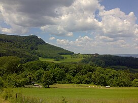
| Fuchseck | |
|---|---|
 | |
| Highest point | |
| Elevation | 762 m (2,500 ft) |
| Coordinates | 48°38′15″N 9°41′12″E / 48.63750°N 9.68667°E / 48.63750; 9.68667 |
| Geography | |
 | |
| Location | Baden-Württemberg, Germany |
| Parent range | Swabian Alb |
The Fuchseck is a 762m high mountain on the northern edge of the Swabian Alb in Baden-Württemberg, Germany.
The mountain is surrounded by the towns of Gammelshausen, Eschenbach, Schlat and Bad Ditzenbach. The summit is on the municipal border of Schlat in the Göppingen District. The mountain is popular for its hiking and mountain biking opportunities.
Nearby mountains include the Wasserberg and Sielenwang.
This Baden-Württemberg location article is a stub. You can help Misplaced Pages by expanding it. |