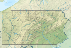
| Fuller Brook Tributary to West Branch Tunungwant Creek | |
|---|---|
  | |
| Location | |
| Country | United States |
| State | Pennsylvania |
| County | McKean |
| Physical characteristics | |
| Source | Linn Brook divide |
| • location | about 6 miles southwest of Bradford, Pennsylvania |
| • coordinates | 41°55′21.22″N 078°45′49.12″W / 41.9225611°N 78.7636444°W / 41.9225611; -78.7636444 |
| • elevation | 2,125 ft (648 m) |
| Mouth | West Branch Tunungwant Creek |
| • location | about 4 miles southwest of Bradford, Pennsylvania |
| • coordinates | 41°54′51.22″N 078°42′39.11″W / 41.9142278°N 78.7108639°W / 41.9142278; -78.7108639 |
| • elevation | 1,581 ft (482 m) |
| Length | 3.03 mi (4.88 km) |
| Basin size | 4.51 square miles (11.7 km) |
| Discharge | |
| • location | West Branch Tunungwant Creek |
| • average | 9.96 cu ft/s (0.282 m/s) at mouth with West Branch Tunungwant Creek |
| Basin features | |
| Progression | West Branch Tunungwant Creek → Tunungwant Creek → Allegheny River → Ohio River → Mississippi River → Gulf of Mexico |
| River system | Allegheny River |
| Tributaries | |
| • left | unnamed tributaries |
| • right | unnamed tributaries |
| Waterbodies | unnamed pond |
| Bridges | Glendorn Drive |
Fuller Brook is a 3.03 mi (4.88 km) long second-order tributary to West Branch Tunungwant Creek.
Course
Fuller Brook rises about 6 miles (9.7 km) southwest of Bradford, Pennsylvania, and then flows east to meet West Branch Tunungwant Creek about 4 miles southwest of Bradford, Pennsylvania.
Watershed
Fuller Brook drains 4.51 square miles (11.7 km) of area, receives about 47.4 in/year (120 cm/year) of precipitation, and is about 90.07% forested.
See also
References
- ^ "Geographic Names Information System". edits.nationalmap.gov. US Geological Survey. Retrieved January 22, 2023.
- ^ "ArcGIS Web Application". epa.maps.arcgis.com. US EPA. Retrieved January 22, 2023.
- ^ "Watershed Report | Office of Water | US EPA". watersgeo.epa.gov. US EPA. Retrieved January 22, 2023.