Human settlement in Scotland
Garscadden
| |
|---|---|
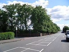
 Corner of Dyke Road and Holehouse Drive Corner of Dyke Road and Holehouse Drive | |
 | |
| OS grid reference | NS521685 |
| Council area | |
| Lieutenancy area |
|
| Country | Scotland |
| Sovereign state | United Kingdom |
| Post town | GLASGOW |
| Postcode district | G14 |
| Dialling code | 0141 |
| Police | Scotland |
| Fire | Scottish |
| Ambulance | Scottish |
| UK Parliament | |
| Scottish Parliament | |
| 55°53′13″N 4°21′59″W / 55.886861°N 4.366265°W / 55.886861; -4.366265 | |
Garscadden (/ɡɑːrˈskædən/; Scottish Gaelic: Gart Sgadan) is a district in the Scottish city of Glasgow. It is situated north of the River Clyde. It lies between Yoker to the west, Scotstoun to the east and Knightswood to the north. It has a train station close to Knightswood shopping centre and Yoker Railway Depot.
Garscadden railway station is on the Argyle Line.
Notes
- "TheGlasgowStory: Early times to 1560: Neighbourhoods". www.theglasgowstory.com.
This Glasgow location article is a stub. You can help Misplaced Pages by expanding it. |