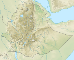
| Gereb Awso | |
|---|---|
 | |
 | |
| Coordinates | 13°25′47″N 39°33′12″E / 13.4296493°N 39.55336882°E / 13.4296493; 39.55336882 |
| Type | Freshwater artificial lake |
| Basin countries | Ethiopia |
| Surface area | 0.0212 km (0.0082 sq mi) |
| Water volume | 0.119×10 |
| Surface elevation | 2,290 m (7,510 ft) |
| Settlements | Kwiha |
Gereb Awso is a reservoir located in the Inderta woreda of the Tigray Region in Ethiopia. The earthen dam that holds the reservoir was built in 1998 by SAERT.
Dam characteristics
- Dam height: 10.5 metres
- Dam crest length: 196 metres
- Spillway width: 3 metres
Capacity
- Original capacity: 118944 m
- Dead storage: 3944 m
- Reservoir area: 2.12 ha
Irrigation
- Designed irrigated area: 9 ha
- Actual irrigated area in 2002: 5 ha
Environment
The catchment of the reservoir is 1.21 km large, with a perimeter of 4.62 km and a length of 1780 metres. The reservoir suffers from rapid siltation. The lithology of the catchment is Agula Shale. Part of the water that could be used for irrigation is lost through seepage; the positive side-effect is that this contributes to groundwater recharge.
References
- ^ De Wit, Joke (2003). Stuwmeren in Tigray (Noord-Ethiopië): kenmerken, sedimentatie en sediment-bronnen. Unpub. M.Sc. thesis. Department of Geography, K.U.Leuven.
- Nigussie Haregeweyn, and colleagues (2006). "Reservoirs in Tigray: characteristics and sediment deposition problems". Land Degradation and Development. 17: 211–230. doi:10.1002/ldr.698. S2CID 129834993.
- Vanmaercke, M. and colleagues (2019). "Sediment Yield and Reservoir Siltation in Tigray". Geo-trekking in Ethiopia's Tropical Mountains. GeoGuide. Cham (CH): Springer Nature. pp. 345–357. doi:10.1007/978-3-030-04955-3_23. ISBN 978-3-030-04954-6. S2CID 199112876.
- Nigussie Haregeweyn, and colleagues (2008). "Sediment yield variability in Northern Ethiopia: A quantitative analysis of its controlling factors". Catena. 75 (1): 65–76. Bibcode:2008Caten..75...65H. doi:10.1016/j.catena.2008.04.011.