| This article does not cite any sources. Please help improve this article by adding citations to reliable sources. Unsourced material may be challenged and removed. Find sources: "Goldenke" – news · newspapers · books · scholar · JSTOR (September 2020) (Learn how and when to remove this message) |
| Goldenke | |
|---|---|
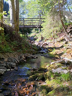
 The Goldenke in Sieber The Goldenke in Sieber | |
| Location | |
| Country | Germany |
| State | Lower Saxony |
| Location | Göttingen district |
| Physical characteristics | |
| Source | |
| • location | By the Goldenkerklippe on the ridge of Auf dem Acker |
| • coordinates | 51°43′54″N 10°24′52″E / 51.73167°N 10.41444°E / 51.73167; 10.41444 |
| • elevation | 800 m above sea level |
| Mouth | |
| • location | into the River Sieber in the village of Sieber |
| • coordinates | 51°41′55″N 10°25′41″E / 51.698528°N 10.427972°E / 51.698528; 10.427972 |
| • elevation | 336 m above sea level |
| Length | 4 km (2.5 mi) |
| Basin size | 5.9 km (2.3 sq mi) |
| Basin features | |
| Progression | Sieber→ Oder→ Rhume→ Leine→ Aller→ Weser→ North Sea |
The Goldenke is a river of Lower Saxony, Germany.
It is a 4 km (2.5 mi) long tributary of the Sieber, north of the village of Sieber in the district of Göttingen. It rises at a height of 800 metres in the vicinity of the Hanskühnenburg on the ridge of Auf dem Acker, by the Goldenkerklippe crags. It then flows mainly in a southerly direction and empties into the River Sieber in the village of the same name.
See also
This Göttingen district location article is a stub. You can help Misplaced Pages by expanding it. |
This article related to a river in Lower Saxony is a stub. You can help Misplaced Pages by expanding it. |