| Gračnica | |
|---|---|
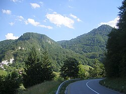
 View of hills in Gračnica from the View of hills in Gračnica from theCelje–Zidani Most road passing Veliko Širje | |
 | |
| Coordinates: 46°6′26.6″N 15°13′21.44″E / 46.107389°N 15.2226222°E / 46.107389; 15.2226222 | |
| Country | |
| Traditional region | Styria |
| Statistical region | Savinja |
| Municipality | Laško |
| Area | |
| • Total | 3.57 km (1.38 sq mi) |
| Elevation | 242.8 m (796.6 ft) |
| Population | |
| • Total | 48 |
| This article relies excessively on references to primary sources. Please improve this article by adding secondary or tertiary sources. Find sources: "Gračnica" – news · newspapers · books · scholar · JSTOR (May 2012) (Learn how and when to remove this message) |
Gračnica (pronounced [ˈɡɾaːtʃnitsa]) is a dispersed settlement in the hills above the left bank of the Savinja River in the Municipality of Laško in eastern Slovenia. The railway line from Zidani Most to Celje runs through the settlement. The area is part of the traditional region of Styria. It is now included with the rest of the municipality in the Savinja Statistical Region.
References
External links
This article about the Municipality of Laško in Slovenia is a stub. You can help Misplaced Pages by expanding it. |
