| Grinnell Falls | |
|---|---|
 Grinnell Falls from Grinnell Glacier Trail Grinnell Falls from Grinnell Glacier Trail | |
 | |
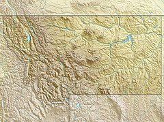
| Location | Glacier National Park (U.S.), Montana, U.S. |
| Coordinates | 48°45′46″N 113°43′12″W / 48.7628578°N 113.7200160°W / 48.7628578; -113.7200160 |
| Type | Cascade/Fall |
| Total height | 960 ft (293 m) |
| Number of drops | 7 |
| Longest drop | 280 ft (85 m) |
| Average flow rate | 0 |
Grinnell Falls is a waterfall in Glacier National Park, Montana, US. Grinnell Falls have several major drops in its 960 feet (290 m) descent from Grinnell Glacier with the highest estimated at 280 ft (85 m). The falls are in the Many Glacier region of the park, between Mount Grinnell and Angel Wing.
References
- "Grinnell Falls". Geographic Names Information System. United States Geological Survey, United States Department of the Interior. Retrieved December 28, 2019.
- "Grinnell Falls". World Waterfall Database.
- Many Glacier, MT (Map). TopoQwest (United States Geological Survey Maps). Retrieved December 28, 2019.

This Montana protected area article is a stub. You can help Misplaced Pages by expanding it. |
This Glacier County, Montana state location article is a stub. You can help Misplaced Pages by expanding it. |