| This article does not cite any sources. Please help improve this article by adding citations to reliable sources. Unsourced material may be challenged and removed. Find sources: "Gulf of Guacanayabo" – news · newspapers · books · scholar · JSTOR (December 2009) (Learn how and when to remove this message) |


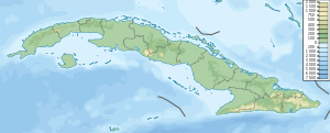
The Gulf of Guacanayabo (Spanish: Golfo de Guacanayabo) is a bay along the southern coast of Cuba, bordered by Granma and Las Tunas provinces.
Overview
The largest port on the bay is Manzanillo, and the gulf is bordered to the north-west by the Jardines de la Reina archipelago. Cuba's longest river, the Cauto River, empties in the Gulf of Guacanayabo.
It is also where, in 2005, Hurricane Dennis had its peak effect.
The Gulf of Guacanayabo is home to the Gran Banco de Buena Espernza reef. The reef spans 25 by 40 kilometers of the central bay and is home to many species adapt at living in the gulf's cloudy, muddy waters. Along with this, the Gulf of Guacanayabo contains the Rio Cauto Delta, which has been a recognized Ramsar site since 2002.
References
https://www.britannica.com/place/Gulf-of-Guacanayabo
https://earthobservatory.nasa.gov/images/146884/cubas-gulf-of-guacanayabo
This Cuban location article is a stub. You can help Misplaced Pages by expanding it. |