| Gulf of Mannar Marine National Park | |
|---|---|
| IUCN category II (national park) | |
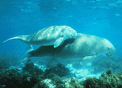
 Dugong, a vulnerable marine mammal Dugong, a vulnerable marine mammal | |
  | |
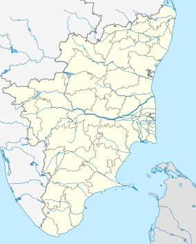
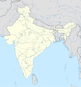
| Location | Coastal regions of Thoothukkudi and Ramanathapuram District, Tamil Nadu, India |
| Nearest city | Rameswaram |
| Coordinates | 09°08′15″N 79°28′21″E / 9.13750°N 79.47250°E / 9.13750; 79.47250 |
| Area | 560 km (220 sq mi) |
| Established | 1986 |
| Governing body | Tamil Nadu Ministry of Environment and Forests |
| forests | |
The Gulf of Mannar Marine National Park is a protected area of India consisting of 21 small islands (islets) and adjacent coral reefs in the Gulf of Mannar in the Indian Ocean. It lies 1 to 10 km away from the east coast of Tamil Nadu, India for 160 km between Thoothukudi (Tuticorin) and Dhanushkodi. It is the core area of the Gulf of Mannar Biosphere Reserve which includes a 10 km buffer zone around the park, including the populated coastal area. The park has a high diversity of plants and animals in its marine, intertidal and near shore habitats. Public access inside the park is limited to glass-bottom boat rides. It was established as a National Park in 1986.
Geography
The 560 km (220 sq mi) park is part of the 140 km long and 25 km wide Mannar barrier reef. It lies between 8° 47' to 9° 15' N latitude and 78° 12' to 79° 14' E longitude. The 21 islands vary from 0.25 hectares (0.62 acres) to 130 ha. (321.2 acres). The total area of the islands is 6.23 km (2.41 sq mi).
The islands (listed southwest to northeast)
Tuticorin group: (4 islands)
Vaan (Vhan), 16.0 ha 8°50′11″N 78°12′38″E / 8.83639°N 78.21047°E / 8.83639; 78.21047
Koswari, 19.50 ha 8°52′08″N 78°13′30″E / 8.86879°N 78.22506°E / 8.86879; 78.22506
Vilanguchalli, 0.95 ha 8°56′17″N 78°16′11″E / 8.93815°N 78.26969°E / 8.93815; 78.26969, now 1 m below mean low tide level as a result of excessive coral mining.
Kariyachalli, 16.46 ha 8°57′15″N 78°15′08″E / 8.95409°N 78.25235°E / 8.95409; 78.25235
Vembar group: (3 islands)
Uppu Thanni, 22.94 ha, elevation 4 m 9°05′21″N 78°29′29″E / 9.08921°N 78.49148°E / 9.08921; 78.49148
Puluvini Challi, 6.12 ha, elevation 5.5 m 9°06′12″N 78°32′13″E / 9.10320°N 78.53688°E / 9.10320; 78.53688
Nalla Thanni, 101.00 ha, elevation 11.9 m (recently populated) 9°06′24″N 78°34′44″E / 9.10667°N 78.57885°E / 9.10667; 78.57885
Kilakarai group: (7 islands)
Anaipar, 11.00 ha, elevation 2.1 m 9°09′11″N 78°41′41″E / 9.15294°N 78.69481°E / 9.15294; 78.69481
Vali Munai, 6.72 ha, elevation 1.2 m 9°09′13″N 78°43′50″E / 9.15354°N 78.73052°E / 9.15354; 78.73052
Poovarasan Patti, 0.50 ha, elevation 1.2 m 9°09′15″N 78°46′01″E / 9.15413°N 78.76695°E / 9.15413; 78.76695
Appa, 28.63 ha, elevation 6.4 m 9°09′57″N 78°49′33″E / 9.16582°N 78.82596°E / 9.16582; 78.82596
Talairi, 75.15 ha, elevation 2.7 m 9°10′53″N 78°54′24″E / 9.18133°N 78.90673°E / 9.18133; 78.90673
Valai 10.10 ha, elevation 3.0 m 9°11′03″N 78°56′19″E / 9.18421°N 78.93866°E / 9.18421; 78.93866
Mulli, 10.20 ha, elevation 1.2 m 9°11′11″N 78°58′05″E / 9.18641°N 78.96810°E / 9.18641; 78.96810

Mandapam group:(7 islands)
Musal, 124.00 ha, elevation 0.9 m 9°11′57″N 79°04′31″E / 9.19912°N 79.07530°E / 9.19912; 79.07530 (recently populated)
Manoli, 25.90 ha 9°12′56″N 79°07′42″E / 9.21564°N 79.12834°E / 9.21564; 79.12834
Manoli-Putti 2.34 ha 9°12′57″N 79°07′41″E / 9.21581°N 79.12800°E / 9.21581; 79.12800
Poomarichan 16.58 ha 9°14′43″N 79°10′48″E / 9.24538°N 79.17993°E / 9.24538; 79.17993
Pullivasal, 29.95 ha 9°14′13″N 79°11′28″E / 9.23699°N 79.19100°E / 9.23699; 79.19100
Kurusadai, 65.80 ha 9°14′49″N 79°12′34″E / 9.24690°N 79.20945°E / 9.24690; 79.20945 was recently populated. Its surrounding shallow waters harbour three species of seagrass that are found nowhere else in India. Representatives of every animal phylum known (except amphibians) are found on this island.
Shingle, 12.69 ha, elevation .6m 9°14′30″N 79°14′08″E / 9.24174°N 79.23563°E / 9.24174; 79.23563
Tidal amplitude in the area is about .5m.
There were two more islands named Pandayan and Punnaiyadi at 8°46′51″N 78°11′43″E / 8.78075°N 78.19536°E / 8.78075; 78.19536 that were destroyed for construction of the new Tuticorn Port facilities.
Flora


The park includes marine components such as coral reefs, seaweed communities, sea grasses, and mangroves.
Mangroves dominate the intertidal zones of the park islands. They consist of species of the genera Rhizophora, Avicennia, Bruguiera, Ceriops and Lumnitzera. The introduced tree genus Prosopis is dominant on land in all the islands. The flowering herb Pemphis acidula (family Lythraceae) is the only endemic plant species. 12 species of sea grass and 147 species of seaweeds were recorded. This vegetation provides important feeding grounds for vulnerable marine mammals such as the dugong, endangered green turtles and olive ridley turtles.
Fauna
Vertebrates
The dugong, a vulnerable marine mammal, is the flagship mammal of the park. It is an important habitat for the cetaceans: Indo-Pacific bottlenose dolphin, finless porpoise, spinner dolphin, common dolphin, Risso's dolphin, melon-headed whale, and dwarf sperm whale. Larger whales include sperm whale, minke whale, Bryde's whale, sei whale, and critically endangered species including humpback whale, fin whale, and blue whale.
About 510 (23%) of the 2,200 fin fish species in Indian waters are found in the Gulf, making it the most highly diverse fish habitat in India. Coral associated ornamental fishes of the family Chaetodontidae (butterfly fish), parrotfish, Amphiprion spp. (clown fish), Holocentrus spp. (squirrel fish), Scarus spp. (parrot fish), Lutjanus spp. (snappers) and Abudefduf saxatilis (sergeant major) are abundant.
A unique endemic species of Balanoglossus – Ptychodera fluva, a living fossil that links invertebrates and vertebrates, has been recorded only at Kurusadai.
Invertebrates
Four species each of shrimp and lobster, 106 species of crab, 17 species of sea cucumber, and 466 species of mollusc including 271 gastropods, 174 bivalves, 5 polyplacophorans, 16 cephalopods and 5 scaphopods, 108 species of sponge, and 100 species of echinoderm occur in the Gulf.
The coral fauna includes 106 species from 30 genus of hermatypes and 11 species from 10 genus of ahermatypes, including 13 new species, giving a total of 117 species from 14 families and 40 genus. The reefs in this area are narrow fringing reefs located 150 to 300 m. from the shore of the islands and patch reefs rising up from depths of 2 to 9 m. and extending up to 2 km. long and 50 m. wide. Large areas of these reefs are in generally poor condition due to destructive human activities of the 150,000 persons living along the coast. Nutrient and other pollution loads are high due to agriculture, deforestation, industry, urbanization and septic pollution. It appears that the coral reefs of the Gulf of Mannar Marine National Park seem to be healthy and in good condition, despite high rates of sedimentation and other threats. However, live coral cover is only about 35%. Various algae cover much of the dead coral.
Stony coral species of families Poritidae and Faviidae constitute the dominant reef builders here. Coral reefs near some of the islands have been heavily damaged by exploitation as raw materials for industrial ventures such as cement industries, brick manufacture, masonry work and lime kilns. Though legal quarrying of the reefs is now stopped, up to 250 m/day of reef were destroyed for many years.
Habitation

The islands are uninhabited except for Krusadai, Musal and Nallathanni islands where antipoaching sheds are operating. Along the coast near the park there are about 125 villages which support about 100,000 people who are mainly Marakeyars, a local community principally engaged in fishing.
Habitat degradation
Experts say that Vaan Island, one of the four islands of the Tuticorn group, has split in two and if immediate efforts are not taken then the island would soon vanish under the sea. Vaan Island, which is the southernmost of the 21 islands in the Gulf of Mannar, was initially spread across 16 hectares, but had shrunk alarmingly by around 10.3 hectares to its current 5.7 hectares in less than three decades. According to J K Patterson Edward, director of Suganthi Devadasan Marine Research Institute (SDMRI), Tuticorin,"Rampant coral mining by people of the fishing villages along the coast is the main cause of the devastation to the island. Coral mining was banned in 2005, but the damage had already been done." Two of the 21 islands have already submerged around a decade ago.
See also
- Indian Council of Forestry Research and Education
- Coral reefs in India
- Central Marine Fisheries Research Institute
- Fisheries College and Research Institute
References
- UNDP (1994). "Conservation and Sustainable-use of the Gulf of Mannar Biosphere Reserve's Coastal Biodiversity" (PDF). UNDP, Project Brief, New York. Archived from the original (PDF) on 21 July 2011. Retrieved 15 October 2007.
- Shaunak B Modi (2011). "Gulf of Mannar Marine National Park - Tamil Nadu Forest Dept. (GOMNP)". Gulf of Mannar Biosphere Reserve Trust. Archived from the original on 2 November 2007. Retrieved 15 October 2007.
- Madhav, Sughosh; Nazneen, Sadaf; Singh, Pardeep, eds. (2021). Coastal ecosystems : environmental importance, current challenges and conservation measures. Cham, Switzerland: Springer International Publishing. p. 15.
- ^ Undp gombr (October 2006). "Annual Project review, Conservation and sustainable use of the Gulf of Mannar Biosphere Reserve's Coastal Biodiversity" (PDF). UNDP GEF APR/PIR 2006 – Biodiversity (1 July 2005 to 30 June 2006). UNDP. Retrieved 16 October 2007.
- ^ IOM (2007). "Gulf of Mannar Biosphere Reserve". Ecologically Important Areas of Tamil Nadu Coast. Institute for Ocean Management, Anna University. Archived from the original on 6 January 2008. Retrieved 15 October 2007.
- ^ J. K. Patterson Edward; Jamila Patterson; G. Mathews; Dan Wilhelmsson. "Status of Coral Reefs of the Tuticorin Coast, Gulf of Mannar, Southeast Coast of India" (PDF). Suganthi Devadason Marine Research Institute. Archived from the original (PDF) on 16 January 2022. Retrieved 15 October 2007.
- ^ OSTI staff (July 2004). "Focus on an Island" (PDF). Ocean Science and Technology for Islands Newsletter, Vol 2.3 Issue 5, p.2. National Institute of Ocean Technology, Chennai. Retrieved 15 October 2007.
- "Gulf of Mannar Biosphere Reserve, India". UNESCO. 18 January 2019. Retrieved 7 July 2022.
- ^ "Gulf of Mannar Marine National Park". Ecologically Important Areas of Tamil Nadu Coast. Tamil Nadu Forest Department. 2007. Archived from the original on 27 October 2007. Retrieved 14 October 2007.
- Jeganathan Stalin (2007). "Vegetation status in the offshore islands of Gulf of Mannar Marine National Park, Tamil Nadu". Wildlife Institute of India. Archived from the original on 21 July 2011. Retrieved 15 October 2007.
- E.V. Muley; J.R.B. Alfred; K. Venkataraman; M.V.M. Wafar (2000). "Status of Coral Reefs of India". 9 ICRS, BALI. Archived from the original on 10 April 2009. Retrieved 15 October 2007.
- Gulf of Mannar Marine National Park. http://www.tuticorincity.info/plan-your-tour/Gulf-of-Mannar-Marine-National-Park.html Archived 13 May 2014 at the Wayback Machine. Tuticorin City. retrieved 13-05-2014
- Wells (1995). "Gulf of Mannar Marine National Park". Cetacean habitat directory for MPAs, national and international sanctuaries. Whale and Dolphin Conservation Society. Retrieved 15 October 2007.
- Active Asia Travel. http://www.hotelsatmaldives.com/Whales.html Archived 13 May 2014 at archive.today retrieved 13-05-2014
- Accounts of Whale Watching in Sri Lanka. http://www.jetwingeco.com/content/accounts-whale-watching-sri-lanka. Jetwing Eco Holidays. retrieved on 13-05-2014
- Balaenoptera edeni. "Bryde's Whale". Archived from the original on 13 May 2014. Retrieved 13 May 2014.. Marine Mammal Conservation Network of India. retrieved 13-05-2014
- Kasim H.M., Balasubramanian S.T., 1989. On the stranding of Sei whale Balaenoptera borealis along Gulf of Mannar coast. Marine Fisheries Information Service, Technical and Extension Series, 95. pp. 12-14. Eprints@CMFRI. http://eprints.cmfri.org.in/3068/. retrieved on 13-05-2014
- Miller M., Scott A., Gulf of Mannar. http://www.psu.edu/dept/nkbiology/India/Gulf_of_Mannar.pdf. Biosphere Reserve Project. retrieved on 13-05-2014
- Marichamy R., Rajapandian M.E., Srinivasan A., 1984. The stranding of rorqual whale Balaenoptera musculus (Linnaeus) in the Gulf of Mannar. Journal of the Marine Biological Association of India. 26. 168-170. Marine Mammal Conservation Network of India. Submit a Record. "Submit a Record". Archived from the original on 13 May 2014. Retrieved 13 May 2014.retrieved 13-05-2014
- Hoon Vineeta (1997). "Coral Reefs of India: Review of Their Extent, Condition, Research and Management Status". FAO, Regional Workshop on the Conservation and Sustainable Management of Coral Reefs. Retrieved 15 October 2007.
- Patterson J.K.
- UNDP (January 2001). "Project Document – Conservation and Sustainable-use of the Gulf of Mannar Biosphere Reserve's Coastal Biodiversity" (PDF). United Nations Development Programme, Global Environment Facility. Archived from the original (PDF) on 15 July 2007. Retrieved 15 October 2007.
- Edward J. K Patterson, Mathews Edward G., Patterson Jamilla, Wilhelmsson Dan, Tamelander Jerjer, Linden Olaf (April 2007) Coral Reefs of The Gulf of Mannar, Southeastern India-Distribution, Diversity and Status, special Research Publication # 12, Suganthi Devadason Marine Research Institute, J.K. Patterson Edward, Director, 44 Beach Road, Tuticorn, Tamil Nadu, 628001 India
- Venkataswaran Dr. V (January 2000) Status Survey of Gulf of Mannar Coral Reefs, Marine Biological Station, Zoological Survey of India, Ministry of Environment and Forests, Govt. of India, 100 San Thome High Road, Chennai, India, 600028
- V.K.Venkataramani and N. Jayakumar (2007). "Biodiversity and biology of marine ornamental reef fishes of Gulf of Mannar – parrotfishes (family: scaridae)" (PDF). Fisheries College and Research Institute, Tamil Nadu Veterinary and Animal Sciences University, Thoothukudi. Archived from the original (PDF) on 27 July 2011. Retrieved 14 October 2007.
- "Gulf of Mannar isle splits in two, may sink". The Times of India. Archived from the original on 12 June 2013. Retrieved 9 June 2013.
Further reading
- Corals images gallery: #1, #2.
- Gulf of Mannar Biosphere Trust
- Conservation and Sustainable-use of the Gulf of Mannar Biosphere Reserve's Coastal Biodiversity, UNDP
- Sea turtles and their Conservation
- Marine Protected Areas of India
| Protected areas of Tamil Nadu | |
|---|---|
| Biosphere reserves | |
| National parks | |
| Wildlife sanctuaries | |
| Bird sanctuaries | |
| Tiger reserves | |
| Elephant reserves | |
| Conservation reserves | |
| Hydrography of the Indian subcontinent | |
|---|---|
| Inland rivers | |
| Inland lakes, deltas, etc. | |
| Coastal | |
| Categories |
|