| Site of Special Scientific Interest | |
 Freshwater West Panorama Freshwater West Panorama | |
 | |
| Location | Pembrokeshire |
|---|---|
| Grid reference | SN1549931781 |
| Coordinates | 51°57′14″N 4°41′10″W / 51.954°N 4.686°W / 51.954; -4.686 |
| Interest | Biological |
| Area | 149.5 hectares (1.5 km; 0.58 sq mi) |
| Notification | 2000 |
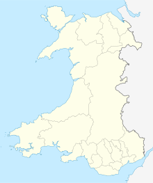
Gweunydd Blaencleddau is a large wetland complex in a shallow south-west valley around the headwaters of the Eastern Cleddau river. It is a Site of Special Scientific Interest (SSSI) and a Special Area of Conservation (SAC) situated in Pembrokeshire, South Wales.
Site of Special Scientific Interest
Gweunydd Blaencleddau is situated at the head of the Eastern Cleddau river, 1.67 miles (2.69 km) south-west of Crymych and covers an area of 149.6 hectares (370 acres) of shallow south-west trending valley between 190 m and 275 m above sea-level. The site was designated an SSSI in 2000 for its biological qualities. It is a mixture of wet heath and damp grassland and has significant populations of the marsh fritillary (Euphydryas aurinia) and the southern damselfly (Coenagrion mercuriale).
Special Area of Conservation
A Special Area of Conservation has also been established around this north-eastern tributary of the Eastern Cleddau river. The site is designated for habitats including calcium-rich springwater-fed fens - Alkaline fens; the southern damselfly (Coenagrion mercuriale); marsh fritillary butterfly Euphydryas (Eurodryas, Hypodryas) aurinia; purple moor-grass meadows - molinia meadows on calcareous, peaty or clayey-silt-laden soils (Molinion caeruleae); wet heathland with cross-leaved heath Rhostiroedd gwlyb - Northern Atlantic wet heaths with Erica tetralix; very wet mires often identified by an unstable 'quaking' surface - transition mires and quaking bogs; and blanket bogs.
See also
References
- "MAGIC Map Application - Gweunydd Blaencleddau SSSI". DEFRA MAGIC Map. DEFRA.
- "Site of Special Scientific Interest, Carmarthenshire, Gweunydd Blaencleddau" (PDF). Natural Resources Wales.
- "Gweunydd Blaencleddau, Special Area of Conservation map" (PDF). Natural Resources Wales.
- "Entry in the Register of European Sites for Wales, Gweunydd Blaencleddau, Special Area of Conservation" (PDF). Natural Resources Wales.
External links
- SSSI & SAC links from Natural Resources Wales