| Halifax Street South Australia | |
|---|---|
 | |
| View of Halifax Street facing east between King William and Pulteney Street Streets | |
 | |
| Coordinates | |
| General information | |
| Type | Street |
| Location | Adelaide city centre |
| Length | 1.5 km (0.9 mi) |
| Opened | 1837 |
| Major junctions | |
| West end | King William Street Adelaide |
| East end | East Terrace Adelaide |
| Location(s) | |
| LGA(s) | City of Adelaide |
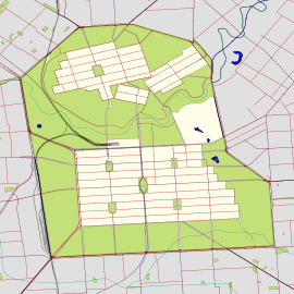
Halifax Street is a street in the south-eastern sector of the centre of Adelaide, South Australia. It runs east–west between East Terrace and King William Street, crossing Hutt Street and Pulteney Street and passing through Hurtle Square. It was named after Sir Charles Wood (later Charles Wood, 1st Viscount Halifax), British Member of Parliament for Halifax.

Halifax Street is one of the intermediate-width streets of the Adelaide grid, at 1+1⁄2 chains (99 ft; 30 m) wide.
Circa 1844 Halifax Street became the location of one of Adelaide's first breweries, founded by William Henry Clark who later built a flour mill close by. The brewery and mill were sited on city acres 564 and 603 between Halifax and Gilles streets which, from 1909 to 1950, housed Adelaide's rubbish incinerator.
Junction list
| Location | km | mi | Destinations | Notes | |
|---|---|---|---|---|---|
| Adelaide city centre | 0 | 0.0 | King William Street | Continues as Sturt Street | |
| 0.55 | 0.34 | Pulteney Street | In Hurtle Square | ||
| 1.1 | 0.68 | Hutt Street | |||
| 1.5 | 0.93 | East Terrace | |||
| 1.000 mi = 1.609 km; 1.000 km = 0.621 mi | |||||
See also
References
- ^ "Halifax Street" (Map). Google Maps. Retrieved 1 June 2022.
- ^ 2003 Adelaide Street Directory, 41st Edition. UBD (A Division of Universal Press Pty Ltd). 2003. ISBN 0-7319-1441-4.
- ^ Map Archived 25 March 2017 at the Wayback Machine of the Adelaide CBD, North Adelaide and the Adelaide Parklands.
- "History of Adelaide Through Street Names". Archived from the original on 9 February 2007. Retrieved 13 December 2006.
- Postcards: The Greek on Halifax: In the Adelaide City region of South Australia Archived 21 March 2012 at the Wayback Machine
- "Local Intelligence". Adelaide Observer. No. 66. 28 September 1844. p. 4. Retrieved 22 May 2017 – via National Library of Australia.
- "Refuse Destructor". Evening Journal. Vol. XLII, no. 11544. Adelaide. 9 March 1908. p. 1. Retrieved 22 May 2017 – via National Library of Australia.
| Streets and squares of Adelaide city centre | ||||||||||||||||||||||||||||||||||||||||||||||||||
|---|---|---|---|---|---|---|---|---|---|---|---|---|---|---|---|---|---|---|---|---|---|---|---|---|---|---|---|---|---|---|---|---|---|---|---|---|---|---|---|---|---|---|---|---|---|---|---|---|---|---|
| ||||||||||||||||||||||||||||||||||||||||||||||||||
34°55′57″S 138°36′33″E / 34.9325°S 138.6093°E / -34.9325; 138.6093
This Australian road or road transport-related article is a stub. You can help Misplaced Pages by expanding it. |
This article about a place in Adelaide is a stub. You can help Misplaced Pages by expanding it. |