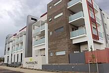
Suburb of Canberra, Australian Capital Territory
| Harrison Canberra, Australian Capital Territory | |||||||||||||||
|---|---|---|---|---|---|---|---|---|---|---|---|---|---|---|---|
 Light rail construction on Flemington Road, Harrison Light rail construction on Flemington Road, Harrison | |||||||||||||||
 | |||||||||||||||
| Coordinates | 35°11′51″S 149°9′16″E / 35.19750°S 149.15444°E / -35.19750; 149.15444 | ||||||||||||||
| Population | 8,244 (SAL 2021) | ||||||||||||||
| Gazetted | 18 October 1991 | ||||||||||||||
| Postcode(s) | 2914 | ||||||||||||||
| Elevation | 612 m (2,008 ft) | ||||||||||||||
| Area | 3.0 km (1.2 sq mi) | ||||||||||||||
| Location |
| ||||||||||||||
| District | Gungahlin | ||||||||||||||
| Territory electorate(s) | Yerrabi | ||||||||||||||
| Federal division(s) | Fenner | ||||||||||||||
| |||||||||||||||
Harrison is a suburb of the district of Gungahlin in Canberra, Australia. The suburb is named after the former city planner Peter Harrison, who was instrumental in reviving Walter Burley Griffin's plan for the National Capital. The suburb is adjacent to the suburbs of Franklin, Gungahlin, Throsby, Kenny and the industrial estate Mitchell. Harrison's place names reflects those of "natural features, waterfalls, plains, tablelands and plateaux". The suburb is located approximately 2 km east of the Gungahlin Town Centre and about 10 km from the centre of Canberra.
Following the launch of Light Rail on 20 April by the ACT government, Harrison residents now have access to Light Rail services from any of the stops along Flemington Road.
Schools
| Name | Suburb | Type | District | Opened | Website | Notes |
|---|---|---|---|---|---|---|
| Harrison School | Harrison | Public | Gungahlin | 2008 | Website | K-10 |
| Mother Teresa Primary School | Harrison | Catholic | Gungahlin | 2010 | Website | K-6 |
| Harrison Early Childhood Centre | Harrison | Private | Gungahlin | 2010 | Website | K-2 |
Parks


| Address | PlayGym |
|---|---|
| Eric Mawson St, Harrison ACT 2914 | No |
| Turtle Rock St, Harrison ACT 2914 | No |
| Tanami St, Harrison ACT 2914 | Yes |
| Moonlight St, Harrison ACT 2914 | Yes |
Geology
See also: Geology of the Australian Capital TerritoryHarrison is underlaid mostly by the Canberra Formation mudstone or volcanics from the late middle Silurian age. Near the eastern corner is an outcrop of the Ainslie Volcanics dacite or andesite.
Footnotes
- Australian Bureau of Statistics (28 June 2022). "Harrison (suburb and locality)". Australian Census 2021 QuickStats. Retrieved 28 June 2022.

- "Suburbs & their names" (PDF). Archives ACT. 8 September 2009. Retrieved 20 February 2023.
- "Suburb Name search results". ACT Environment and Sustainable Development. Retrieved 10 February 2014.
- "Light Rail Launch - Transport Canberra". www.transport.act.gov.au. Archived from the original on 20 April 2019.
- Henderson G A M and Matveev G, Geology of Canberra, Queanbeyan and Environs 1:50000 1980.
| Suburbs in Gungahlin | |
|---|---|
|