| This article needs additional citations for verification. Please help improve this article by adding citations to reliable sources. Unsourced material may be challenged and removed. Find sources: "High Park, Merseyside" – news · newspapers · books · scholar · JSTOR (January 2021) (Learn how and when to remove this message) |
| High Park | |
|---|---|
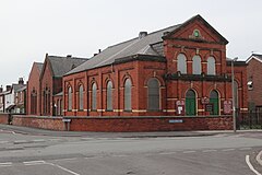
 Russell Road Methodist Church Russell Road Methodist Church | |
  | |
| Population | 8,000 |
| • Density | 4,324 |
| Metropolitan borough | |
| Metropolitan county | |
| Region | |
| Country | England |
| Sovereign state | United Kingdom |
| Post town | SOUTHPORT |
| Postcode district | PR9 |
| Dialling code | 01704 |
| Police | Merseyside |
| Fire | Merseyside |
| Ambulance | North West |
| UK Parliament | |
| |
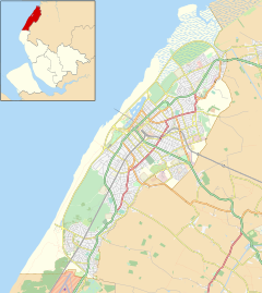
High Park is a suburb of Southport, Merseyside, England. It is located on the eastern fringe on the town, just south of Churchtown. High Park Road is within the area of Metropolitan Borough of Sefton who provide services such as refuse collection and are responsible for the collection of council tax. High Park is one of two areas in Norwood (ward), the other being Blowick.
References
- Caldwell, David. "What you need to know about High Park Road in the town of Southport". Street List. Retrieved 15 September 2020.
| Suburbs of Southport | |
|---|---|