| Honobia Creek Wildlife Management Area | |
|---|---|
| Honobia Creek WMA | |
| IUCN category V (protected landscape/seascape) | |
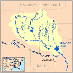
 Map of the Little River watershed through Honobia Creek WMA Map of the Little River watershed through Honobia Creek WMA | |
 | |
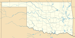
| Location | Pushmataha, Le Flore, and McCurtain Counties, Oklahoma |
| Nearest city | Rattan, Oklahoma |
| Coordinates | 34°22′33″N 95°14′48″W / 34.37583°N 95.24667°W / 34.37583; -95.24667 (Cloudy Nashoba Trail) |
| Area | 97,758.18 acres (395.6133 km) |
| Governing body | Private land managed by the Oklahoma Department of Wildlife Conservation (ODWC) |
Honobia Creek Wildlife Management Area is a protected area of privately owned land located in Pushmataha, Le Flore, and McCurtain Counties, Oklahoma, totaling 97,758.18 acres (39,561.33 ha), and managed by the Oklahoma Department of Wildlife Conservation (ODWC).
Organization
Three private forest investment companies, the Hancock Natural Resource Group (HNRG), Rayonier Forest Resources, and Molpus Timberlands Management, entered into agreements with the Oklahoma Department of Wildlife Conservation (ODWC) in 2010 to manage the states first privately owned WMA. The property is run under a land access fee permit system.
Location
Located in the southeast corner of Oklahoma twenty-one miles of the upper course of the Little River flows through the WMA. The 203,246 acres (82,251 ha) Three Rivers WMA shares 16 miles (26 km) of border on the east side.
See also
List of Oklahoma Wildlife Management Areas
References
- Honobia Creek WMA- Retrieved 2019-09-29
- Honobia WMA partnership- Retrieved 2019-09-27
- The Oklahoman: Honobia Creek remains intact with new lease- Retrieved 2019-09-29