| Hoppet | |
|---|---|
 | |
  | |
| Coordinates: 59°1′34″N 18°8′48″E / 59.02611°N 18.14667°E / 59.02611; 18.14667 | |
| Country | Sweden |
| Province | Södermanland |
| County | Stockholm County |
| Municipality | Haninge Municipality |
| Area | |
| • Total | 4.56 km (1.76 sq mi) |
| Population | |
| • Total | 218 |
| • Density | 47.8/km (124/sq mi) |
| Time zone | UTC+1 (CET) |
| • Summer (DST) | UTC+2 (CEST) |
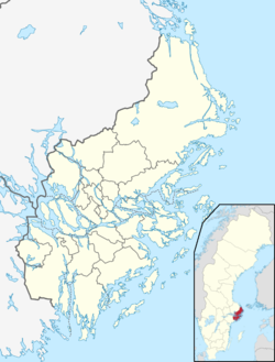
Hoppet is an urban area on the island of Muskö and in Haninge Municipality, Stockholm County, Sweden.
References
- "Landareal per tätort, folkmängd och invånare per kvadratkilometer. Vart femte år 1960 - 2016" [Land area per urban area, population and inhabitants per square kilometer. Every fifth year 1960 - 2016] (in Swedish). Statistics Sweden. Archived from the original on 13 June 2017. Retrieved 18 May 2017.
| Localities in Haninge Municipality, Stockholm County, Sweden | |
|---|---|
| Localities: |
|
This article about a location in Stockholm County, Sweden is a stub. You can help Misplaced Pages by expanding it. |