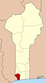
| Houéyogbé | |
|---|---|
| Commune and city | |
 | |
| Coordinates: 6°30′32.4″N 1°49′37.2″E / 6.509000°N 1.827000°E / 6.509000; 1.827000 | |
| Country | |
| Department | Mono Department |
| Area | |
| • Total | 110 sq mi (290 km) |
| Population | |
| • Total | 74,492 |
| Time zone | UTC+1 (WAT) |
Houéyogbé [we.jɔg.be] is a town, arrondissement, and commune in the Mono Department of south-western Benin. The commune covers an area of 290 square kilometres and as of 2002 had a population of 74,492 people.
References
- "Houeyogbe". Atlas Monographique des Communes du Benin. Retrieved January 5, 2010.
- "Communes of Benin". Statoids. Archived from the original on March 24, 2012. Retrieved January 5, 2010.
6°27′N 1°56′E / 6.450°N 1.933°E / 6.450; 1.933
| Athiémè |  | |
|---|---|---|
| Bopa | ||
| Comè | ||
| Grand-Popo | ||
| Houéyogbé | ||
| Lokossa | ||
This Mono Department location article is a stub. You can help Misplaced Pages by expanding it. |
