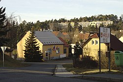
| Hrdlív | |
|---|---|
| Municipality | |
 Municipal office Municipal office | |
 Flag Flag Coat of arms Coat of arms | |
 | |
| Coordinates: 50°11′58″N 14°4′21″E / 50.19944°N 14.07250°E / 50.19944; 14.07250 | |
| Country | |
| Region | Central Bohemian |
| District | Kladno |
| First mentioned | 1316 |
| Area | |
| • Total | 1.70 km (0.66 sq mi) |
| Elevation | 285 m (935 ft) |
| Population | |
| • Total | 518 |
| • Density | 300/km (790/sq mi) |
| Time zone | UTC+1 (CET) |
| • Summer (DST) | UTC+2 (CEST) |
| Postal code | 273 06 |
| Website | www |
Hrdlív (pronounced [ˈɦr̩dliːf]) is a municipality and village in Kladno District in the Central Bohemian Region of the Czech Republic. It has about 500 inhabitants.
Etymology
The name is derived from the personal name Hrdlej or Hrlej.
Geography
Hrdlív is located about 6 kilometres (4 mi) north of Kladno and 23 km (14 mi) northwest of Prague. It lies in the Prague Plateau. The highest point is at 338 m (1,109 ft) above sea level.
History
The first written mention of Hrdlív is from 1316. From the 15th century, Hrdlív was part of the Smečno estate, which belonged to the Martinic family (since 1792 Clam-Martinic). After the abolition of feudalism in 1848, Hrdlív became part of the Třebichovice municipality. In 1906, it became a separate municipality.
Demographics
|
|
| ||||||||||||||||||||||||||||||||||||||||||||||||||||||
| Source: Censuses | ||||||||||||||||||||||||||||||||||||||||||||||||||||||||
Transport
There are no railways or major roads passing through the municipality.
Sights

Hrdlív is poor in monuments. The only protected cultural monument is a small Baroque chapel dating from 1745.
References
- "Population of Municipalities – 1 January 2024". Czech Statistical Office. 2024-05-17.
- ^ "Slánsko" (in Czech). Infocentre Slaný. Retrieved 2022-03-01.
- ^ "Historie obce" (in Czech). Obec Hrdlív. Retrieved 2022-03-01.
- "Historický lexikon obcí České republiky 1869–2011" (in Czech). Czech Statistical Office. 2015-12-21.
- "Population Census 2021: Population by sex". Public Database. Czech Statistical Office. 2021-03-27.
- "Výsledky vyhledávání: Kulturní památky, obec Hrdlív". Ústřední seznam kulturních památek (in Czech). National Heritage Institute. Retrieved 2024-07-04.