
This is an alphabetical list of articles related to the U.S. State of Colorado.
Contents
0–9
- .co.us – Internet second-level domain for the State of Colorado
- 4 Corners
- 6th Principal Meridian
- 10-mile Range
- 10th Mountain Division (United States)
- 16th Street Mall
- 25th meridian west from Washington
- 32nd meridian west from Washington
- 37th parallel north
- 38th parallel north
- 39th parallel north
- 40th parallel north
- 41st parallel north
- 64 counties of the State of Colorado
- 100 km isolated peaks of Colorado
- 103rd meridian west
- 104th meridian west
- 105th meridian west
- 106th meridian west
- 107th meridian west
- 108th meridian west
- 109th meridian west
- 1500 meter prominent peaks of Colorado
- 4000 meter peaks of Colorado
- 5280 magazine website
- 14,000-foot peaks of Colorado
A


- Adams County, Colorado
- Adams-Onís Treaty of 1819
- Adjacent States: (seven, the third most of the 50 states)
- Agloves
- Airports of Colorado
- Alamosa County, Colorado
- Sidney Altman
- Colorado in the American Civil War
- American Ranch massacre
- Amusement parks in Colorado
- Ancestral Puebloans - Native Americans
- Antilocapra americana
- Aquamarine - Colorado state gemstone
- Aquaria in Colorado
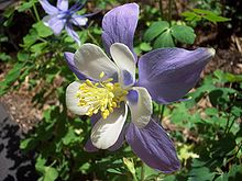
- Aquilegia coerulea - Colorado state flower
- Arapaho Nation of Native Americans
- Arapahoe County, Colorado
- Arapahoe County, Kansas Territory
- Arrappahoe County, Jefferson Territory
- Arboreta in Colorado
- Archuleta County, Colorado
- Arkansas River
- Art museums and galleries in Colorado
- Astronomical observatories in Colorado
- Attorney General of the State of Colorado website
- Aurora, Colorado
B
- Baca County, Colorado
- Battle of Beecher Island
- Battle of Julesburg
- Battle of Summit Springs
- Ballot measures of Colorado
- Beaver County, Utah Territory
- Charles Bent
- William Bent
- Bent County, Colorado
- Blue grama - Colorado state grass
- Boards of cooperative educational services in Colorado website
- Botanical gardens in Colorado
- Boulder County, Colorado
- Bouteloua gracilis - Colorado state grass
- Broderick County, Kansas Territory
- City and County of Broomfield, Colorado
- Margaret Brown
- Mary Babnik Brown
- Buildings and structures in Colorado
C
- Calamospiza melanocorys - Colorado state bird
- Calhan Paint Mines Archeological District
- Camp Carson
- Camp Collins
- Camp Hale
- Ben Nighthorse Campbell
- Capital of the State of Colorado website
- Capitol of the State of Colorado website
- Carbonate County, Colorado
- Scott Carpenter
- Kit Carson
- Thomas Cech
- Choirs in Colorado
- Census designated areas of Colorado
- Census statistical areas of Colorado
- Centennial State - Colorado state nickname
- Chaffee County, Colorado
- Don Cheadle
- Cherokee Ranch
- Cherokee Ranch petrified forest
- Cheyenne County, Colorado
- Cheyenne County, Jefferson Territory
- Cheyenne Nation of Native Americans
- Chronology of the Colorado Constitution
- Chrysemys picta bellii - Colorado state reptile
- Cities - see List of municipalities in Colorado
- Civil War military units from Colorado
- Clear Creek County, Colorado
- Climate of Colorado
- Climate change in Colorado
- CO – United States Postal Service postal code for the State of Colorado
- Coal mining in Colorado
- Colleges and universities in Colorado

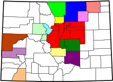
- Colorado website
- Colorado Air National Guard website
- Colorado Amendment 20
- Colorado Army National Guard website
- Colorado Authors Hall of Fame
- Colorado Aviation Hall of Fame
- Colorado blue spruce - Colorado state tree
- Colorado breweries
- Colorado census designated places
- Colorado census statistical areas
- Colorado cities and towns
- Colorado City, territorial capital 1862
- Colorado Coalfield War
- Colorado Convention Center
- Colorado counties
- Colorado Court of Appeals
- Colorado drainage basins
- Colorado Eastern Plains
- Colorado Education Association
- Colorado Engineering Experiment Station, Inc.
- Colorado forts
- Colorado Fuel and Iron
- Colorado General Assembly
- Colorado ghost towns
- Colorado Governor's Mansion
- Colorado hairstreak butterfly - Colorado state insect
- Colorado House of Representatives
- Colorado in the American Civil War
- Colorado Labor Wars
- Colorado Lottery website
- Colorado lunar sample displays
- Colorado Media School
- Colorado metropolitan areas
- Colorado Mineral Belt
- Colorado Mining Association
- Colorado municipalities
- Colorado orogeny
- Colorado Parks and Wildlife website
- Colorado Piedmont
- Colorado places
- Colorado Plateau
- Colorado poetry fellowship
- Colorado professional sports teams
- Colorado Public Radio
- Colorado Public Utilities Commission website
- Colorado River
- Colorado River Water Conservation District
- Colorado Scenic and Historic Byways
- Colorado School of Mines website
- Colorado Senate
- Colorado Silver Boom
- Colorado Springs, Colorado
- Colorado State Capitol website
- Colorado State Fair website
- Colorado State Forest website
- Colorado state government website
- Colorado state highways website
- Colorado State Patrol website
- Colorado state prisons
- Colorado state representatives
- Colorado state senators
- Colorado state symbols website
- Colorado state tartan website
- Colorado State University website
- Colorado Supreme Court
- Colorado War
- Colorado Water Trust
- Colorado wine
- Colorado-Big Thompson Project
- Columbine High School massacre of 1999
- Columbine Mine massacre of 1927
- Columbine State
- Comanche Nation of Native Americans website
- Community colleges of Colorado website
- Community Foundation of Northern Colorado
- Companies in Colorado
- Edward Condon
- Conejos County, Colorado
- Congressional districts of Colorado
- Constitution of the State of Colorado website
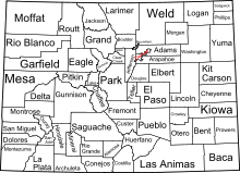
- Cooperative educational services in Colorado website
- Adolph Coors
- Coors Field
- Counties of Colorado website
- Court of Appeals of the State of Colorado website
- Costilla County, Colorado
- Cripple Creek miners' strike of 1894
- Crowley County, Colorado
- Custer County, Colorado
D

- Delta County, Colorado
- Demographics of Colorado website
- John Denver
- Denver, Colorado, territorial and state capital since 1867
- Denver City, capital of the extralegal Jefferson Territory 1859–1860, capital of the Colorado Territory 1861-1862 and 1867–1876
- City and County of Denver, Colorado
- Denver and Rio Grande Western Railroad
- Denver International Airport
- Denver Regional Council of Governments
- Dick's Sporting Goods Park
- Dolores County, Colorado
- Dominguez-Escalante Expedition, 1776
- Douglas County, Colorado
- Drainage basins of Colorado website
E
- Eagle County, Colorado
- Economy of Colorado
- Education in Colorado
- Dwight Eisenhower
- Mamie Eisenhower
- El Paso County, Colorado
- El Paso County, Jefferson Territory
- El Paso County, Kansas Territory
- Elbert County, Colorado
- Elections in the state of Colorado
- English Retreads
- Environment of Colorado
- John Evans (Colorado governor)
- Evans, Colorado
- Evans Memorial Chapel
- Evans Peak
- Execution in Colorado
- Executive branch of the government of the State of Colorado
- Executive Recycling
F

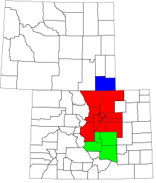
- Festivals in Colorado
- Films set in Colorado
- Films shot in Colorado
- Flag of the State of Colorado
- Gerald Ford
- Fort Collins, Colorado
- Fortieth parallel north
- Forts in Colorado:
- Forty-first parallel north
- Fountain County, Jefferson Territory
- Four Corners
- Fourteeners of Colorado website
- Fremont County, Colorado
- Fremont County, Kansas Territory
- Front Range
- Front Range Urban Corridor
- Hildreth Frost
G


- George Gamow
- Garfield County, Colorado
- Charles Gates, Jr.
- General Assembly of Colorado website
- Geography of Colorado
- Geology of Colorado
- Georgetown Loop
- Gilpin County, Colorado
- Ghost towns in Colorado
- Gold mining in Colorado
- Gold Rush, Pike's Peak
- Golden City, capital of the extralegal Jefferson Territory 1860–1861, capital of Colorado Territory 1862-1867
- Government of the State of Colorado website
- Governor of the State of Colorado website
- Grand County, Colorado
- Great American Desert
- Great Plains
- Great Salt Lake County, Utah Territory
- Great Seal of the State of Colorado
- Julia Greeley
- Greeley, Colorado
- Green River
- Green River County, Utah Territory
- Greenback cutthroat trout - Colorado state fish
- Greenwood County, Colorado Territory
- Guadalupe County, Colorado Territory
- Gunnison County, Colorado
H
- John L. Hall
- Patrick J. Hamrock
- Michael Hancock
- Heele County, Jefferson Territory
- Heritage railroads in Colorado
- High Plains
- High schools of Colorado
- Higher education in Colorado
- Highest major peaks of Colorado
- Highest State
- Hiking trails in Colorado
- Highway routes in Colorado
- Hinsdale County, Colorado
- Historic byways of Colorado
- Historic counties of Colorado
- History of Colorado
- Hospitals in Colorado
- Hot springs of Colorado
- House of Representatives of the State of Colorado
- Huerfano County, Colorado
- Hypaurotis crysalus - Colorado state insect
I
- Images of Colorado
- Insignia of the State of Colorado website
- Iron County, Utah Territory
- James Irwin
J
- William Henry Jackson
- Jackson County, Colorado
- Jackson County, Jefferson Territory
- Jefferson County, Colorado
- Jefferson County, Jefferson Territory
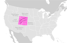
- Jefferson Territory
- Judicial branch of the government of the State of Colorado
K
L

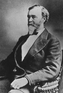


- La Plata County, Colorado
- Lake County, Colorado
- Lakes of Colorado
- Lakewood, Colorado
- Landmarks in Colorado
- Larimer County, Colorado
- Lark bunting - Colorado state bird
- Las Animas County, Colorado
- Law enforcement agencies of Colorado
- Laws of the State of Colorado website
- Legislative branch of the government of the State of Colorado
- Lieutenant Governor of the State of Colorado website
- Lincoln County, Colorado
- Lists related to the State of Colorado:
- List of airports in Colorado
- List of ballot measures in Colorado
- List of boards of cooperative educational services in Colorado
- List of census designated places in Colorado
- List of census statistical areas in Colorado
- List of cities and towns in Colorado
- List of Civil War units from Colorado
- List of colleges and universities in Colorado
- List of companies based in Colorado
- List of Colorado counties by socioeconomic factors
- List of counties in Colorado
- List of drainage basins in Colorado
- List of dams and reservoirs in Colorado
- List of forts in Colorado
- List of ghost towns in Colorado
- List of governors of Colorado
- List of high schools in Colorado
- List of highways in Colorado
- List of hospitals in Colorado
- List of individuals executed in Colorado
- List of insignia of the State of Colorado
- List of lakes in Colorado
- List of law enforcement agencies in Colorado
- List of lieutenant governors of Colorado
- List of metropolitan areas in Colorado
- List of military facilities in Colorado
- List of mountain passes of Colorado
- List of mountain ranges of Colorado
- List of mountains of Colorado
- List of municipalities of Colorado
- List of museums in Colorado
- List of natural forests in Colorado
- List of national grasslands in Colorado
- List of national historic landmarks in Colorado
- List of national historic sites in Colorado
- List of national historic trails in Colorado
- List of national monuments in Colorado
- List of national parks in Colorado
- List of national recreation areas in Colorado
- List of national recreation trails in Colorado
- List of National Register of Historic Places in Colorado
- List of national scenic byways in Colorado
- List of national scenic trail in Colorado
- List of national wilderness areas in Colorado
- List of national wildlife refuges in Colorado
- List of newspapers in Colorado
- List of people from Colorado
- List of places in Colorado
- List of post offices in Colorado
- List of power stations in Colorado
- List of prehistoric sites in Colorado
- List of professional sports teams of Colorado
- List of radio stations in Colorado
- List of railroads in Colorado
- List of Registered Historic Places in Colorado
- List of reservoirs in Colorado
- List of rivers of Colorado
- List of scenic and historic byways in Colorado
- List of school districts in Colorado
- List of ski resorts in Colorado
- List of snakes in Colorado
- List of state forests of Colorado
- List of state parks of Colorado
- List of state prisons of Colorado
- List of state representatives of Colorado
- List of state senators of Colorado
- List of symbols of the State of Colorado
- List of television stations in Colorado
- List of trails in Colorado
- List of United States census statistical areas in Colorado
- List of United States congressional delegations from Colorado
- List of United States congressional districts in Colorado
- List of United States representatives from Colorado
- List of United States senators from Colorado
- List of territorial claims and designations in Colorado
- List of watersheds in Colorado
- Logan County, Colorado
- Louisiana Purchase of 1803
- Ludlow, Colorado
- Ludlow Massacre
M


- Maps of Colorado
- Mass media in Colorado
- Meeker Massacre
- Mesa County, Colorado
- Metropolitan areas of Colorado
- Military facilities in Colorado
- Glenn Miller
- Mineral Belt of Colorado
- Mineral County, Colorado
- Mines, Colorado School of website
- Mining in Colorado
- David Moffat
- Moffat County, Colorado
- Montana County, Kansas Territory
- Montezuma County, Colorado
- Montrose County, Colorado
- Monuments and memorials in Colorado
- Mora County, New Mexico Territory
- Morgan County, Colorado
- Most isolated major peaks of Colorado
- Most prominent peaks of Colorado
- Mother of Rivers
- Mountain County, Jefferson Territory
- Mountain passes of Colorado
- Mountain peaks of Colorado
- Mountain ranges of Colorado
- List of municipalities in Colorado
- Museum Store Company
- Museums in Colorado
- Music of Colorado
N


- National forests of Colorado
- Arapaho National Forest
- Grand Mesa National Forest
- Gunnison National Forest
- Pike National Forest
- Rio Grande National Forest
- Roosevelt National Forest
- Routt National Forest
- San Isabel National Forest
- San Juan National Forest
- Uncompahgre National Forest
- White River National Forest
- Category:National forests of Colorado
- National grasslands of Colorado
- National historic landmarks of Colorado
- National historic sites of Colorado
- National historic trails of Colorado
- National Ice Core Laboratory
- National Mining Hall of Fame
- National monuments of Colorado
- National parks of Colorado
- National recreation areas of Colorado
- National Register of Historic Places in Colorado
- National recreation trails of Colorado
- National scenic trail of Colorado
- National Western Stock Show
- National wilderness areas of Colorado
- National wildlife refuges of Colorado
- Native American peoples of Colorado
- Natural arches of Colorado
- Natural gas pipelines in Colorado
- Natural history of Colorado
- New Mexico Meridian
- Newspapers of Colorado
- Nil sine numine - Colorado state motto
- Gustaf Nordenskiöld
- North Central Colorado Urban Area
- North County, Jefferson Territory
- North Front Range Metropolitan Planning Organization website
- North Platte River
O

- Occupational education in Colorado website
- Oncorhynchus clarki stomias - Colorado state fish
- Oro County, Kansas Territory
- Otero County, Colorado
- Ouray
- Ouray County, Colorado
- Ovis canadensis canadensis - Colorado state mammal
P

- William Jackson Palmer
- Park County, Colorado
- Park County, Jefferson Territory
- Trey Parker
- Peketon County, Kansas Territory
- People from Colorado
- Pepsi Center
- Phantom Canyon (Fort Collins Area)
- Phillips County, Colorado
- Picea pungens (Colorado blue spruce) - Colorado state tree
- Pike's Peak Country
- Pike's Peak Gold Rush
- Pikes Peak
- Pitkin County, Colorado
- List of places in Colorado
- List of forts in Colorado
- List of ghost towns in Colorado
- List of populated places in Colorado
- Platte County, Colorado Territory
- Politics of Colorado
- Professional sports in Colorado
- Pronghorn
- Protected areas of Colorado
- Prowers County, Colorado
- Public Utilities Commission of the State of Colorado website
- Pueblo County, Colorado
Q
R

- Radio stations in Colorado
- Railroad museums in Colorado
- Railroads in Colorado
- Rangeview Library District
- Regional Transportation District website
- Registered historic places of Colorado
- Religion in Colorado
- REMP
- Rhodochrosite - Colorado state mineral
- Rio Blanco County, Colorado
- Rio Grande
- Rio Grande County, Colorado
- Rivers of Colorado
- Rock formations in Colorado
- Rocky Mountain bighorn sheep - Colorado state mammal
- Rocky Mountain columbine - Colorado state flower
- Rocky Mountain Empire
- "Rocky Mountain High" - Colorado state song
- Rocky Mountain oysters
- Rocky Mountains
- Stuart Roosa
- Routt County, Colorado
- Karl Rove
S

- Saguache County, Colorado
- Ceran Saint-Vrain
- Saint Charles Reservoir
- St. Vrain County, Jefferson Territory
- San Juan County, Colorado
- San Miguel County, Colorado
- Sand Creek Massacre
- Sanpete County, Utah Territory
- Saratoga County, Jefferson Territory
- Scenic byways of Colorado
- School districts of Colorado
- School of Mines, Colorado website
- Scientific and Cultural Facilities District website
- Scouting in Colorado
- Seal of the State of Colorado
- Secretary of the State of Colorado website
- Sedgwick County, Colorado
- Seitz - Colorado state soil
- Senate of the State of Colorado
- Settlements - see List of populated places in Colorado
- Shoshone Nation of Native Americans
- Silver Boom of Colorado
- Silver mining in Colorado
- Sixteenth Street Mall
- Sixth Principal Meridian
- Ski resorts of Colorado website
- Snakes of Colorado
- Solar power in Colorado
- South Arapahoe County, Colorado
- South Central Colorado Urban Area
- South Platte River
- South Park
- Southern Rocky Mountains
- Special districts of Colorado website
- Sports in Colorado
- Sports Authority Field at Mile High
- Square dance - Colorado state folk dance
- State capital of Colorado website
- State Capitol of Colorado website
- State highways of Colorado website
- State of Colorado website
- Constitution of the State of Colorado website
- Government of the State of Colorado
- Category:Government of Colorado
- Executive branch of the government of the State of Colorado website
- Governor of the State of Colorado website
- Colorado Department of Agriculture (CDA) website
- Colorado Department of Corrections (CDOC) website
- Colorado Department of Education (CDE) website
- Colorado Department of Higher Education (CDHE) website
- Colorado Department of Human Services (CDHS) website
- Colorado Department of Military and Veterans Affairs (DMVA) website
- Colorado Department of Natural Resources (CDNR) website
- Colorado Department of Revenue (DOR) website
- Colorado Department of Transportation (CDOT) website
- Lieutenant Governor of the State of Colorado website
- Secretary of the State of Colorado website
- Attorney General of the State of Colorado website
- Treasurer of the State of Colorado website
- Governor of the State of Colorado website
- Legislative branch of the government of the State of Colorado website
- Judicial branch of the government of the State of Colorado website
- State of Deseret
- State parks of Colorado website
- State Patrol of Colorado website
- State prisons of Colorado
- State representatives of Colorado
- State senators of Colorado
- Stegosaurus - Colorado state fossil
- Matt Stone
- Structures in Colorado
- Summit County, Colorado
- Superfund sites in Colorado
- Supreme Court of the State of Colorado website
- Jack Swigert
- Symbols of the State of Colorado
T



- Table of Colorado municipalities by county
- Horace Tabor
- Taos County, New Mexico Territory
- Telecommunications in Colorado
- Telephone area codes in Colorado
- Television shows set in Colorado
- Television stations in Colorado
- Teller County, Colorado
- Tenth Mountain Division
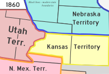
- Territory of Colorado, 1861–1876
- Territory of Jefferson, 1859–1861
- Territory of Kansas, 1854–1861
- Territory of Louisiana, 1805–1812
- Territory of Missouri, 1812–1821
- Territory of Nebraska, (1854–1861)-1867
- Territory of New Mexico, (1850–1861)-1912
- Territory of Utah, (1850–1861)-1896
- Nikola Tesla
- Theatres in Colorado
- Thirty-eighth parallel north
- Thirty-ninth parallel north
- Thirty-seventh parallel north
- Timberline
- Tourism in Colorado website
- Towns - see List of municipalities in Colorado
- Trails of Colorado
- Transportation in Colorado
- Treasurer of the State of Colorado website
- Treaty of Guadalupe Hidalgo of 1848
U


- Ultra prominent peaks of Colorado
- Uncompaghre County, Colorado
- United States Air Force Academy website
- United States of America
- States of the United States of America
- United States census statistical areas of Colorado
- United States congressional delegations from Colorado
- United States congressional districts in Colorado
- United States Court of Appeals for the Tenth Circuit
- United States District Court for the District of Colorado
- United States representatives from Colorado
- United States senators from Colorado
- United States Olympic Committee
- Universities and colleges in Colorado
- University of Colorado System website
- Unsinkable Margaret Brown
- Uranium mining in Colorado
- US-CO – ISO 3166-2:US region code for the State of Colorado
- Utah County, Utah Territory
- Ute Meridian
- Ute Nation of Native Americans
V
W

- Washington County, Colorado
- Washington County, Utah Territory
- Water parks in Colorado
- Waterfalls of Colorado
- Watersheds of Colorado website
- Weld County, Colorado
- Western Federation of Miners
- Western painted turtle - Colorado state reptile
- "Where the Columbines Grow" - Colorado state song
- Byron White
- Carl Wieman
- Wikimedia
- Wind power in Colorado
- Repopulation of wolves in Colorado
- World Heritage Sites in Colorado
X
Y

Z
Contents
See also
- Bibliography of Colorado
- Geography of Colorado
- History of Colorado
- List of Colorado-related lists
- Outline of Colorado
Notes
- ^ One of the 17 original counties created by the Territory of Colorado on November 1, 1861.
- ^ A county in both the Territory of Colorado and the State of Colorado.
- ^ A territorial county which existed within the boundaries of the present State of Colorado prior to the formation of the Territory of Colorado on February 28, 1861.
- ^ A historic county which no longer exists.
- ^ One of the 12 counties created by the extralegal Territory of Jefferson on November 28, 1859.
- Great Salt Lake County, Utah Territory, was renamed Salt Lake County on January 29, 1868.
- Guadalupe County, Colorado Territory, was renamed Conejos County on November 7, 1861.
- The name of South Arapahoe County, Colorado, was changed back to Arapahoe County on April 11, 1903.
- The name of Uncompaghre County, Colorado, was changed back to Ouray County on March 2, 1883.
External links
| Indices | |
|---|---|
38°59′50″N 105°32′52″W / 38.9972°N 105.5478°W / 38.9972; -105.5478 (State of Colorado)