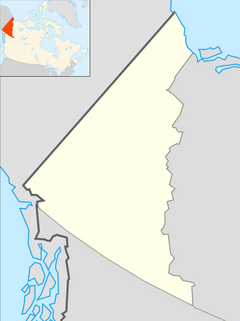
| Indian River | |
|---|---|
 Panning for gold on the Indian River, 1904; photo by Joseph Tyrrell, Thomas Fisher Rare Book Library Panning for gold on the Indian River, 1904; photo by Joseph Tyrrell, Thomas Fisher Rare Book Library | |
 | |
| Location | |
| Country | Canada |
| Territory | Yukon |
| Physical characteristics | |
| Source confluence | Australia Creek, Dominion Creek, Scribner Creek and Wounded Moose Creek |
| • coordinates | 63°37′08″N 138°42′16″W / 63.61889°N 138.70444°W / 63.61889; -138.70444 |
| • elevation | 487 m (1,598 ft) |
| Mouth | Yukon River |
| • coordinates | 63°47′08″N 139°43′39″W / 63.78556°N 139.72750°W / 63.78556; -139.72750 |
| • elevation | 333 m (1,093 ft) |
| Basin features | |
| River system | Bering Sea drainage basin |
The Indian River is a river in Yukon, Canada. It is in the Bering Sea drainage basin and is a right tributary of the Yukon River.
Course
The river begins at the confluence of Australia Creek, Dominion Creek, Scribner Creek and Wounded Moose Creek, about 5 kilometres (3.1 mi) southwest of the settlement of Dominion. It flows northwest, then turns west to reach its mouth at the Yukon River.
Geology
The river is a gravel-bed stream located south of Dawson City. It lies on the Klondike Plateau, and forms the southern boundary of the Yukon placer gold district. Indian River and its tributaries are the largest gold producers in the Yukon. In 2001, the river produced 119,999 grams (4,232.8 oz) of gold. In 2008, Klondike Star Mineral Corporation announced plans to further develop the gold resources of the river.
Tributaries
- Bertha Creek (right)
- Nine Mile Creek (right)
- Ophir Creek (right)
- Ruby Creek (left)
- Quartz Creek (right)
- McKinnon Creek (left)
- New Zealand Creek (right)
- Montana Creek (left)
- Eureka Creek (left)
Further reading
- Unrau, Jason (2012-02-23). "How a novice miner survived a summer in the Klondike". Report on Business Magazine. The Globe and Mail. Retrieved 2012-03-02. An account of working a season at a placer gold mining camp in the Indian River valley; mentions Quartz Creek and Ruby Creek tributaries, and Little Blanche Creek sub-tributary.
See also
References
- "Indian River". Geographical Names Data Base. Natural Resources Canada. Retrieved 2012-01-23.
- "Gazetteer of Yukon" (PDF). Yukon Tourism and Culture - Cultural Services Branch - Heritage Resources Unit - Geographical Names Program. March 2011. p. 32. Archived from the original (PDF) on 2011-08-27. Retrieved 2012-01-23.
- ^ "Indian River". Atlas of Canada. Natural Resources Canada. 2010-02-04. Retrieved 2012-01-23. Shows the course of the river highlighted on a map.
- ^ Nelson, Faye EN; Jackson, Lionel E Jr (2003). "High-level terraces, Indian River valley, Yukon" (PDF). In Emond, DS; Lewis, LL (eds.). Yukon Exploration and Geology 2004. Yukon Geological Survey. pp. 177–190. Retrieved 2012-01-23.
- "Klondike Star greenlights Indian River gold project". Klondike Star Mineral Corporation. July 29, 2008. Retrieved May 13, 2009.