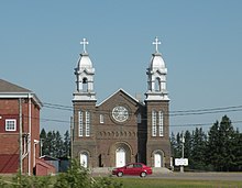
Inkerman is a community in the Canadian province of New Brunswick on Inkerman Lake. It is located mainly on Route 113.
History
The place is named after the Battle of Inkerman in the Crimean War.
The area was once served by the Caraquet and Gulf Shore Railway, a section of which ran between Tracadie and Shippagan. In 2017, a 500 metre former railway bridge, then being used as part of the Sentier NB Trail, was destroyed by fire.
Demographics
In the 2021 Census of Population conducted by Statistics Canada, Inkerman had a population of 712 living in 321 of its 344 total private dwellings, a change of 10.9% from its 2016 population of 642. With a land area of 24.19 km (9.34 sq mi), it had a population density of 29.4/km (76.2/sq mi) in 2021.
See also
References
- Hamiton, William Baillie (1996). Place Names of Atlantic Canada (illustrated, reprint ed.). University of Toronto Press. p. 87. ISBN 0802075703. Retrieved 17 October 2017.
- Woods, Shirley E. (1992). Cinders & Saltwater: The Story of Atlantic Canada's Railways. Halifax: Nimbus. pp. 162–163.
- Fraser, Elizabeth (15 September 2017). "Fire that destroyed Inkerman bridge suspicious, RCMP say". CBC News. Canadian Broadcasting Corporation. Retrieved 31 August 2022.
- "Population and dwelling counts: Canada and designated places". Statistics Canada. February 9, 2022. Retrieved January 2, 2025.
47°40′04″N 64°49′29″W / 47.667671°N 64.824786°W / 47.667671; -64.824786
This New Brunswick location article is a stub. You can help Misplaced Pages by expanding it. |