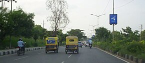
 National Highway 648
 | |
|---|---|
| Nelamangala - Bidadi - Anekal Expressway | |
| Location | |
| Country | India |
| Highway system | |
| Inner Ring Road | |
|---|---|
| Bangalore Inner Ring Road highlighted in Red | |
 | |
| Route information | |
| Maintained by Bangalore Development Authority, Bruhat Bangalore Mahanagara Palike | |
| Length | 10 km (6.2 mi) |
| Location | |
| Country | India |
| State | Karnataka |
| Highway system | |
| State Highways in Karnataka | |
Inner Ring Road : is passing through route with Nelamangala, Tavarekere, Bidadi, Harohalli, Tattekere, Anekal, Atthibele, Sarjapura, Dunnasandra, Hosakote, Sulibele, Airport, Rajanukunte and Madure these 14 towns connected. This road 8 lane access control highway and 2 lane service road facility provided. arterial road in Bangalore, India. It is a six-lane link road connecting Indiranagar and Koramangala. The northern end of the road, beyond Old Airport Road from Domlur junction is called 100 Feet Road.
Inner and intermediate ring road


The Inner ring road in Bangalore is link road connecting Indiranagar and Koramangala. A number of MNCs, such as IBM, Dell, Lenovo, Continuous Computing and Microsoft are located along this road. The northern end of the road, beyond Old Airport Road is called 100 ft Road Indiranagar.
The IRR forms an important link for the Information Technology Corridor, which extends through Whitefield - Old Airport Road - Koramangala - Hi Tech City (proposed) and finally to Electronics City.
A number of important companies in the IT industry have their offices at the "Embassy Golf Links" just off the IRR close to HAL Airport.
A big flyover has been constructed at the Domlur Junction of the IRR and Old Airport Road. It has helped in the decongestion of traffic at the Domlur signal.
Much of the land around the IRR is fenced barren defense land, which eliminates instances of people or animals crossing the road.
See also
References
- "City still has rain hangover". The Hindu. Retrieved 24 February 2012.
- "BBMP's first budget tomorrow". The Hindu. 29 March 2007. Archived from the original on 20 January 2008. Retrieved 24 February 2012.
- "SEZ to be established near Hosur at Rs. 512 cr". The Hindu. 25 August 2006. Archived from the original on 28 March 2007. Retrieved 24 February 2012.
- Mondal, Sudipto (17 November 2011). "The Domlur of old". Bangalore: The Hindu. Retrieved 9 May 2012.