| This article needs additional citations for verification. Please help improve this article by adding citations to reliable sources. Unsourced material may be challenged and removed. Find sources: "Iranshahr Airport" – news · newspapers · books · scholar · JSTOR (May 2015) (Learn how and when to remove this message) |
Airport in Iranshahr, Iran
| Iranshahr Airport ایرانشہر بالی پَٹ | |||||||||||
|---|---|---|---|---|---|---|---|---|---|---|---|
| Summary | |||||||||||
| Airport type | Public/Military | ||||||||||
| Owner | Government of Iran | ||||||||||
| Operator | Iran Airports Company Islamic Revolutionary Guard Corps Iranian Police Aviation | ||||||||||
| Serves | Iranshahr | ||||||||||
| Location | Iranshahr, Iran | ||||||||||
| Elevation AMSL | 2,040 ft / 622 m | ||||||||||
| Coordinates | 27°14′9″N 60°43′13″E / 27.23583°N 60.72028°E / 27.23583; 60.72028 | ||||||||||
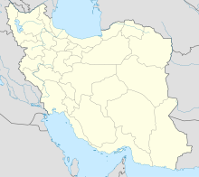
| Map | |||||||||||
 | |||||||||||
| Runways | |||||||||||
| |||||||||||
| Statistics (۱۳۹۳ - 2014) | |||||||||||
| |||||||||||
| Source: Iranian Airports Holding Company | |||||||||||
Iranshahr Airport (IATA: IHR, ICAO: OIZI) (Balochi: ایرانشہربالی پَٹ) is an airport serving Iranshahr, in Iran's Sistan and Baluchestan province.
Airlines and destinations
| Airlines | Destinations |
|---|---|
| Mahan Air | Jiroft, Tehran–Mehrabad |
| Pars Air | Tehran–Mehrabad |
References
- "Flight status84-91". Archived from the original on 31 May 2014. Retrieved 16 June 2014. (May 2015).
- "List of all airports in Iran". The Airport Authority. Retrieved 2 January 2019.
This article about an Iranian airport is a stub. You can help Misplaced Pages by expanding it. |