| Jakta | |
|---|---|
 Jakta seen from Slogen Jakta seen from Slogen | |
| Highest point | |
| Elevation | 1,588 m (5,210 ft) |
| Prominence | 539 m (1,768 ft) |
| Coordinates | 62°10′16″N 6°37′00″E / 62.1710°N 6.6167°E / 62.1710; 6.6167 |
| Geography | |
  | |
| Location | Møre og Romsdal, Norway |
| Parent range | Sunnmørsalpene |
| Topo map | 1219 III Hjørundfjord |
| Climbing | |
| First ascent | 1896: H.C. Bowen and C.W. Patchell |
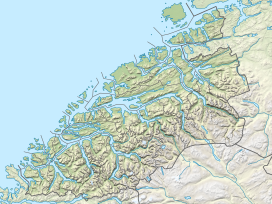
Jakta is a 1,588-metre (5,210 ft) tall mountain in the Sunnmørsalpene mountain range. It is located in the municipality of Ørsta in Møre og Romsdal county, Norway. Jakta lies 5 kilometres (3.1 mi) south of the nearby mountain Slogen and just across the Hjørundfjorden from the mountain Skårasalen. The village of Leira lies 5 kilometres (3.1 mi) south of Jakta.
On August 2, 1896, the two Brits H.C. Bowen and Cecil W. Patchell became the first known people to reach the top of Jakta.
See also
References
- "Jakta, Ørsta (Møre og Romsdal)" (in Norwegian). yr.no. Retrieved 2019-09-15.
- "Jakta, 1589m". WestCoastPeaks.com. Retrieved 2010-09-21.
External links
This Møre og Romsdal location article is a stub. You can help Misplaced Pages by expanding it. |