| Jarčje Brdo | |
|---|---|
 | |
 | |
| Coordinates: 46°10′34.35″N 14°12′18.5″E / 46.1762083°N 14.205139°E / 46.1762083; 14.205139 | |
| Country | |
| Traditional region | Upper Carniola |
| Statistical region | Upper Carniola |
| Municipality | Gorenja Vas–Poljane |
| Area | |
| • Total | 1.05 km (0.41 sq mi) |
| Elevation | 664.4 m (2,179.8 ft) |
| Population | |
| • Total | 25 |
| • Density | 24/km (62/sq mi) |
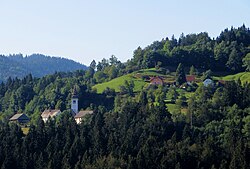
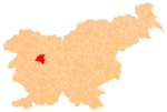
Jarčje Brdo (pronounced [ˈjaːɾtʃjɛ ˈbəɾdɔ]; in older sources also Jarče Brdo, German: Jartschinberdo) is a dispersed settlement in the hills between the Selca Sora and the Poljane Sora valleys in the Municipality of Gorenja Vas–Poljane in the Upper Carniola region of Slovenia.
Name
Jarčje Brdo was attested in historical sources as Jartschemwerdi in 1500. The dialect adjective jarčji means 'sheep', and so the name Jarčje Brdo literally means 'sheep hill'.
Church

The local church is dedicated to Saint Valentine. It was built between 1854 and 1857 on the site of an earlier church and has a triple nave. The belfry from the earlier church, dating to 1728, is preserved.
References
- Statistical Office of the Republic of Slovenia
- ^ Leksikon občin kraljestev in dežel zastopanih v državnem zboru, vol. 6: Kranjsko. 1906. Vienna: C. Kr. Dvorna in Državna Tiskarna, p. 58.
- Gorenja Vas–Poljane municipal site
- "Jarčje Brdo". Slovenska historična topografija. ZRC SAZU Zgodovinski inštitut Milka Kosa. Retrieved August 14, 2020.
- Slovar slovenskega knjižnega jezika (2 ed.). Ljubljana: Inštitut za slovenski jezik Frana Ramovša ZRC SAZU. 2014. Retrieved August 14, 2020.
- Official Journal of the Republic of Slovenia, No 14/2004, 13. Feb. 2004, declaring the church a cultural monument of local interest(in Slovene)
External links
 Media related to Jarčje Brdo at Wikimedia Commons
- Jarčje Brdo on Geopedia
This article about the Municipality of Gorenja vas-Poljane in Slovenia is a stub. You can help Misplaced Pages by expanding it. |
