| Jbel Tamarrakoit | |
|---|---|
 | |
| Highest point | |
| Elevation | 2,345 m (7,694 ft) |
| Coordinates | 33°03′44″N 5°03′55″W / 33.0623°N 5.0652°W / 33.0623; -5.0652 |
| Geography | |
| Location | Fès-Meknès, Morocco |
| Parent range | Middle Atlas |
| Geology | |
| Rock age | Pleistocene |
| Mountain type | Shield volcano |
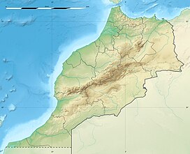
Jbel Tamarrakoit is an extinct shield volcano located 60 km south of the city of Ifrane in the Middle Atlas of Morocco. This mountain is one of the three main volcanic structures of the Azrou region along with Jbel El Koudiate and Jbel Outgui.
See also
References
- Kharbouch, Fatima; Cotten, Joseph; Youbi, Nasrrddine; Bellon, Hervé; Maury, René C.; El Azzouzi, M'Hammed (2010). "Petrology and K-Ar chronology of the Neogene-Quaternary Middle Atlas basaltic province, Morocco". Bulletin de la Société Géologique de France. 181 (3): 243–257. doi:10.2113/gssgfbull.181.3.243.
This Fès-Meknès location article is a stub. You can help Misplaced Pages by expanding it. |
