| This article needs additional citations for verification. Please help improve this article by adding citations to reliable sources. Unsourced material may be challenged and removed. Find sources: "Jeziorany" – news · newspapers · books · scholar · JSTOR (February 2018) (Learn how and when to remove this message) |
| Jeziorany | |
|---|---|
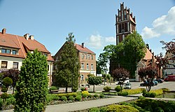
 Town square with the church of Saint Bartholomew Town square with the church of Saint Bartholomew | |
 Coat of arms Coat of arms | |
 | |
| Coordinates: 53°58′N 20°44′E / 53.967°N 20.733°E / 53.967; 20.733 | |
| Country | |
| Voivodeship | Warmian-Masurian |
| County | Olsztyn |
| Gmina | Jeziorany |
| Area | |
| • Total | 3.41 km (1.32 sq mi) |
| Population | |
| • Total | 3,320 |
| • Density | 970/km (2,500/sq mi) |
| Time zone | UTC+1 (CET) |
| • Summer (DST) | UTC+2 (CEST) |
| Postal code | 11-320 |
| Vehicle registration | NOL |
Jeziorany (; formerly known in Polish as Zybork, German: Seeburg) is a town in Olsztyn County, Warmian-Masurian Voivodeship, Poland, with 3,320 inhabitants (2010).
Jeziorany is a member of Cittaslow.
Demographics
| Year | Pop. | ±% |
|---|---|---|
| 1871 | 2,916 | — |
| 1880 | 2,960 | +1.5% |
| 1890 | 2,797 | −5.5% |
| 1900 | 3,023 | +8.1% |
| 1910 | 2,965 | −1.9% |
| 1925 | 2,847 | −4.0% |
| 1939 | 3,022 | +6.1% |
| 1950 | 1,659 | −45.1% |
| 1960 | 2,913 | +75.6% |
| 2010 | 3,320 | +14.0% |
| Source: | ||
References
- ^ Stan i struktura ludności oraz ruch naturalny w przekroju terytorialnym w 2010 r. (PDF) (in Polish). Warszawa: Główny Urząd Statystyczny. 2011. p. 101. Archived from the original (PDF) on 13 November 2011.
- "Map of East Prussia; 1882".
- Dokumentacja Geograficzna (in Polish). Vol. 3/4. Warszawa: Instytut Geografii Polskiej Akademii Nauk. 1967. p. 31.
| Gmina Jeziorany | ||
|---|---|---|
| Town and seat |  | |
| Villages | ||
This Olsztyn County location article is a stub. You can help Misplaced Pages by expanding it. |