| Juicetrump Hill | |
|---|---|
 The summit of Juicetrump Hill from the south. The summit of Juicetrump Hill from the south. | |
| Highest point | |
| Elevation | 124 m (407 ft) |
| Parent peak | Park Hill |
| Coordinates | 53°16′10″N 0°04′08″W / 53.269458°N 0.068985°W / 53.269458; -0.068985 |
| Geography | |
 | |
| Parent range | Lincolnshire Wolds |
| OS grid | TF 28878 76457 |
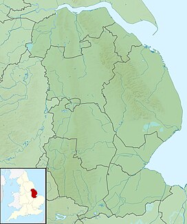
Juicetrump Hill is a hill around half a mile north of Belchford and 4.5 miles north-east of Horncastle in Lincolnshire, UK within the Lincolnshire Wolds. The summit elevation is 124 m (407 ft) and it forms part of the slightly higher Park Hill with its summit of 140m just to the north-east. The Database of British and Irish Hills records Park Hill as having a height of 139 m (456 ft), and a topographic prominence (drop) of 31 m (102 ft), and being a TuMP ("Thirty and upwards Metre Prominence").
It is a limestone outcrop known as a Roachstone with the underlying Tealby Clays having been eroded at a faster rate.
The Viking Way long-distance footpath runs along the western flank of the hill, though there is no public access to the summit itself.
On the summit is a possible Neolithic long barrow, though this is disputed.
See also
References
- "Park Hill". Hill Bagging. Database of British and Irish Hills. Retrieved 29 April 2024.
- "In the Shadow of Juicetrump (Belchford 4.5 miles)". Lincolnshire Wolds Countryside Service. Retrieved 2023-09-26.
- "Heritage Gateway - Results". www.heritagegateway.org.uk. Retrieved 2023-09-26.