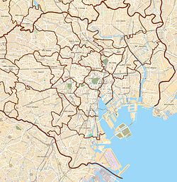
| Kaigan 海岸 | |
|---|---|
| District | |
 Takeshiba Pier Park and Takeshiba Passenger Ship Terminal (back) Takeshiba Pier Park and Takeshiba Passenger Ship Terminal (back) | |
  | |
| Coordinates: 35°39′9.54″N 139°45′3.75″E / 35.6526500°N 139.7510417°E / 35.6526500; 139.7510417 | |
| Country | Japan |
| Region | Kantō |
| Prefecture | Tokyo |
| Ward | Minato |
| Area | |
| • Total | 1.13 km (0.44 sq mi) |
| Population | |
| • Total | 6,444 |
| Time zone | UTC+9 (JST) |
| Zip code | 105-0022 (1-2 chome) 108-0022 (Sanchome) |
| Area code | 03 |
Kaigan (海岸) is a district of Minato, Tokyo, Japan. The current administrative place names are Kaigan 1-chome to Kaigan 3-chome. It is an area where the residential address has been displayed. Kaigan 1-chome belongs to the Shiba district general branch office, and Kaigan 2-3 chome belongs to the Shibaura-Kōnan district general branch.
Education
Minato City Board of Education operates public elementary and junior high schools.
Kaigan 1-chōme is zoned to Onarimon Elementary School (御成門小学校) and Onarimon Junior High School (御成門中学校). Kaigan 2-chōme is zoned to Shiba Elementary School (芝小学校) and Mita Junior High School (港区立三田中学校). 1-3, 14-19, and 22-30-ban of Kaigan 3-chōme are zoned to Shibahama Elementary School (芝浜小学校) while 4-13, 20-21, and 31-33-ban of 3-chōme are zoned to Shibaura Elementary School (芝浦小学校). All of 3-chōme is zoned to Konan Junior High School (港南中学校).
References
- 平成27年国勢調査による各総合支所管内別の町丁目別面積・昼夜人口等. 港区. 2015-10-01. Retrieved 2019-09-08.
- 各月1日現在の各総合支所管内別の町丁目別人口・世帯数(平成14年~平成31年・令和元年). 港区. 2019-08-01. Retrieved 2019-09-08.
- "港区立小・中学校通学区域一覧表(令和4年4月以降)" (PDF). City of Minato. Retrieved 2022-10-08.
This Tokyo location article is a stub. You can help Misplaced Pages by expanding it. |
