| This article is an orphan, as no other articles link to it. Please introduce links to this page from related articles; try the Find link tool for suggestions. (February 2022) |
Village in Maharashtra, India
| Kanoli | |
|---|---|
| village | |
  | |
| Coordinates: 19°31′45″N 74°17′42″E / 19.5291°N 74.295°E / 19.5291; 74.295 | |
| Country | |
| State | Maharashtra |
| District | Ahmadnagar |
| Taluka | Sangamner |
| Government | |
| • Body | Village Panchayat |
| Languages | |
| • Official | Marathi |
| Time zone | UTC+5:30 (IST) |
| PIN | 422605 |
| Lok Sabha constituency | Shirdi |
| Vidhan Sabha constituency | Sangamner |
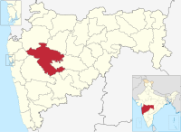
Kanoli is a small village located in Maharashtra, India, in Sangamner tehsil of Ahmadnagar district. The nearest town is Sangamner, located approximately 16 km to the northwest.
Kanoli has a population of approximately 3,600. It is part of the Shirdi assembly and parliamentary constituency.
References
- "PIN Code of Kanoli, SANGAMNER,AHMEDNAGAR, MAHARASHTRA". www.upiqrcode.com. Retrieved 16 June 2021.
- "Kanoli · Maharashtra 422605, India". Google Maps. Retrieved 17 June 2021.
| Ahmednagar district topics | ||
|---|---|---|
| History |  | |
| Geography | ||
| Talukas | ||
| Cities and towns | ||
| Monuments | ||
| Education | ||
| Lok Sabha constituencies | ||
| Vidhan Sabha constituencies | ||
| Dams in District | ||
This Ahmednagar district, Maharashtra, India location article is a stub. You can help Misplaced Pages by expanding it. |