| Karl Marx Peak | |
|---|---|
 | |
| Highest point | |
| Elevation | 6,723 m (22,057 ft) |
| Prominence | 2,693 m (8,835 ft) |
| Listing | Ultra |
| Coordinates | 37°09′45″N 72°28′54″E / 37.16250°N 72.48167°E / 37.16250; 72.48167 |
| Geography | |
 | |
| Location | GBAO, Tajikistan |
| Parent range | Shakhdara Range (Pamirs) |
| Climbing | |
| First ascent | 1946 by Evgeniy Beletskiy et al. |
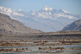
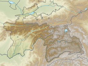
Karl Marx Peak (Russian: Пик Карла Маркса; Tajik: Қуллаи Карл Маркс) rises to 6,723 m (22,057 ft) in the Shakhdara Range in Pamir Mountains, in the south-west of Tajikistan's Gorno-Badakhshan Autonomous Province (eastern part of Ishkoshim district), just north of the Panj River and the Afghanistan border. It was named after the German philosopher Karl Marx whose theories were the basis of communism and socialism. The highest summit in the Shakhdara Range, it was discovered and named in 1937 by Soviet geologist and explorer of South-West Pamir Sergey Klunnikov. The ascent was delayed by the outbreak of World War II, and Karl Marx Peak was first climbed in 1946 by a group of Soviet alpinists led by Evgeniy Beletskiy.
References
- ^ "The Central Asian Republics - Ultra Prominence Page" Peaklist.org. Listed as "Pik Karla Marksa". Retrieved 2011-12-11.
- Big Soviet Encyclopedia, on-line edition (in Russian).
- "Pik Karl Marx" in Encarta World Atlas. Archived June 29, 2006, at the Wayback Machine
- "Pik Karl Marx, Tajikistan" Peakbagger.com. Retrieved 2011-12-11.
- Discovery of Karl Marx Peak (in Russian).
- First ascent (in Russian).
External links
- "Karl Marx Peak". Peakware.com. Archived from the original on 2016-03-04.
| Gorno-Badakhshan | ||
|---|---|---|
| Capital: Khorugh | ||
| Districts |  | |
| Main cities and towns | ||
| Geography | ||
| Rivers | ||
This Tajikistan location article is a stub. You can help Misplaced Pages by expanding it. |