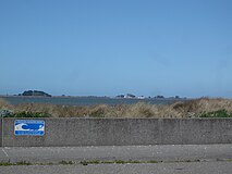
Unincorporated community in California, United States
| King Salmon, California | |
|---|---|
| Unincorporated community | |
 Houses are built along canals in King Salmon Houses are built along canals in King Salmon | |
 | |
| Coordinates: 40°44′21″N 124°13′07″W / 40.73917°N 124.21861°W / 40.73917; -124.21861 | |
| Country | United States |
| State | California |
| County | Humboldt County |
| Elevation | 3 ft (1 m) |
King Salmon is an unincorporated community in Humboldt County, California, United States, located on the shore of Buhne Point directly across from the entrance to Humboldt Bay, slightly south of Eureka and 1 mile (1.6 km) north of Fields Landing, at an elevation of 3 feet (0.91 m). It has a Eureka zipcode and area code and is part of Greater Eureka.
Overview
Once a small fishing enclave, primarily containing summer homes or vacation homes and is the former site of the Humboldt Bay Nuclear Power Plant. The Sequoia Humane Society is a privately funded no-kill shelter for dogs and cats that sponsors "Woofstock" every year at Eureka's Halvorsen Park.
King Salmon is served by the Redwood Transit System, has marina services and a recreational vehicle park as well as a public picnic area on the top of Buhne Point adjacent to the power plant. Construction of a groin in 1983 slowed erosion along the shoreline of King Salmon, sand was added to make the beach.
References
- ^ U.S. Geological Survey Geographic Names Information System: King Salmon
- Madge Caughman; Joanne S. Ginsberg (1987). The California Coastal Resource Guide. University of California Press. ISBN 978-0-520-06186-6. Retrieved March 23, 2013.
- Durham, David L. (1998). California's Geographic Names: A Gazetteer of Historic and Modern Names of the State. Quill Driver Books. p. 88. ISBN 978-1-884995-14-9.
- Kim Kavin (November 17, 2008). The Everything Family Guide to Northern California and Lake Tahoe: A complete guide to San Francisco, Yosemite, Monterey, and Lake Tahoe - and all the beautiful spots in between. Adams Media. pp. 391–. ISBN 978-1-4405-2187-4. Retrieved September 23, 2013.
- Sequoia Humane Society webpage, 2013, accessed September 23, 2013
- ^ California Coastal Access Guide. University of California Press. 1991. ISBN 978-0-520-05051-8.
This Humboldt County, California–related article is a stub. You can help Misplaced Pages by expanding it. |

