31°35′N 78°25′E / 31.583°N 78.417°E / 31.583; 78.417 Kinnaur district is a mountainous district of the Himachal Pradesh state in north India. Kinnaur is located in the northeast corner of Himachal Pradesh, bordering Tibet to the east. The administrative headquarters of the district is at Reckong Peo. The revered Kinnaur Kailash mountain, one of the Panch Kailash sites, is situated in Kinnaur. As of 2011, it is the second least populous district of Himachal Pradesh (out of 12 districts), after Lahaul and Spiti.
District of Himachal Pradesh in India| Kinnaur district | |
|---|---|
| District of Himachal Pradesh | |
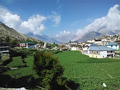
     Clockwise from top-left: Kamru Fort, Chandika Devi Temple, Reckong Peo, Nako Lake, Kinnaur Kailash, view of Kalpa Clockwise from top-left: Kamru Fort, Chandika Devi Temple, Reckong Peo, Nako Lake, Kinnaur Kailash, view of Kalpa | |
 Location in Himachal Pradesh Location in Himachal Pradesh | |
| Country | |
| State | |
| Headquarters | Reckong Peo |
| Tehsils | Kalpa, Pooh, Sangla, Moorang, Hangrang, Bhaba Nagar. |
| Area | |
| • Total | 6,401 km (2,471 sq mi) |
| Population | |
| • Total | 84,121 |
| • Density | 13/km (34/sq mi) |
| • Urban | 0.00% |
| Demographics | |
| • Literacy | 88.37%(male), 71.34%(female) |
| • Sex ratio | 819 |
| Time zone | UTC+05:30 (IST) |
| Vehicle registration | HP-25, HP-26, HP-27 |
| Major highways | National Highway 5 (India) |
| Website | hpkinnaur |
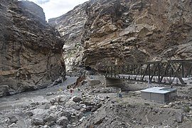
The district was opened to outsiders in 1989. The old Hindustan-Tibet Road passes through the Kinnaur valley along the bank of river Sutlej and finally enters Tibet at Shipki La pass. Kinnaur is the second richest district in terms of per capita income after Solan in Himachal Pradesh.
History
Over the 10th-11th centuries A.D., Kinnaur was a part of the Guge kingdom. The Guge kingdom broke apart in the 12th century, and the Bushahr state arose in the Western Himalayas, taking over most parts of present-day Kinnaur. The Bushahr state originated in the Kamru village of Sangla valley. However, the uppermost part of Kinnaur remained under Tibetan influence until the late 17th century, when it was handed over to the Bushahr state by the Tibetans as a reward for assistance in the Tibet-Ladakh-Mughal War. The Bushahr state shifted its capital to Sarahan, and later still to Rampur, which caused this state to be known eventually as 'Rampur-Bushahr'. Rampur-Bushahr was attacked by the Gurkhas in the early 19th century. After the British gained supremacy in the region soon afterwards, this state became a princely state owing suzerainty to the British crown, until India's Independence in 1947. Kinnaur was known as 'Chini tehsil' under the Bushahr state. On 15 April, 1948, Rampur-Bushahr became a part of the Republic of India, and a part of an administrative unit called the Mahasu district. In 1960, the region under the erstwhile Rampur-Bushahr state was separated from Mahasu district and made into a new district called the Kinnaur district. The Kinnaur district includes the erstwhile Chini tehsil plus fourteen villages of the erstwhile Rampur tehsil.
Geography
Kinnaur is an entire mountainous district. The general altitude range is 1,500 metres above sea level to over 6,000 metres above sea level. The district is drained by several tributaries of the Sutlej river. Three mountain ranges run through or touch Kinnaur: the Zanskar range, the Great Himalaya range, and the Dhauladhar range. The highest peak of Kinnaur district, Leo Purgyil (6,816m), is also the highest peak of Himachal Pradesh state. The Kinner Kailash peak (6,050m), a regional pilgrimage site for Hindus, is also located in Kinnaur.
Administratively, Kinnaur is the third largest district by size in Himachal Pradesh, with an area of 6,401 sq. km. The district has five tehsils (Nichar, Kapla, Sangla, Pooh, and Moorang) and one sub-tehsil (Hangrang). For development purposes, the district is divided into three developmental blocks - Nichar, Kalpa, and Pooh.
Demographics
According to the 2011 census, Kinnaur district has a population of 84,121. This gives it a ranking of 620th in India (out of a total of 640). The district has a population density of 13 inhabitants per square kilometre (34/sq mi). Its population growth rate over the decade 2001-2011 was 7.61%. Kinnaur has a sex ratio of 819 females for every 1000 males, and a literacy rate of 80%. The entire population was rural. Scheduled Castes and Scheduled Tribes make up 17.53% and 57.95% of the population respectively.
| Religions in Kinnaur district (2011) | ||||
|---|---|---|---|---|
| Religion | Percent | |||
| Hinduism | 76.95% | |||
| Buddhism | 21.50% | |||
| Christianity | 0.58% | |||
| Islam | 0.53% | |||
| Other or not stated | 0.44% | |||
| Distribution of religions | ||||
Languages of Kinnaur district (2011)
Kinnauri (72.05%) Hindi (8.03%) Nepali (7.03%) Pahadi (3.47%) Bhojpuri (1.04%) Others (8.38%)| Year | Pop. | ±% p.a. |
|---|---|---|
| 1901 | 27,232 | — |
| 1911 | 28,470 | +0.45% |
| 1921 | 28,191 | −0.10% |
| 1931 | 30,445 | +0.77% |
| 1941 | 33,238 | +0.88% |
| 1951 | 34,475 | +0.37% |
| 1961 | 40,980 | +1.74% |
| 1971 | 49,835 | +1.98% |
| 1981 | 59,547 | +1.80% |
| 1991 | 71,270 | +1.81% |
| 2001 | 78,334 | +0.95% |
| 2011 | 84,121 | +0.72% |
| source: | ||
Languages
Kannaura people speak about eight language varieties, seven from Sino-Tibetan language family; Kinnauri, Chitkuli, Sumcho, Jangrami, Poo Kinnauri, Sunam, Nesang and one from an Indo-Aryan language family, called Pahari Kinnauri. Also see At the 2011 census, 72% of the population in the district spoke or knew native languages of Kinnaur, 16.65% Hindi and 7.03% Nepali as their first language. Although, Hindi is fast emerging as the language of choice in most domains, especially the young speakers, due to the demands of modernity which has threatened the native languages.
Climate
Most of Kinnaur enjoys a temperate climate due to its high elevation, with long winters from October to May, and short summers from June to September. The lower parts of the Sutlej Valley and the Baspa Valley receive monsoon rains. The Baspa valley receives highest rainfall in July month. The upper areas of the valleys fall mainly in the rain-shadow area. These areas are considered to be arid regions, similar to the climate of Tibet and Central Asian countries. A study by the IIT Delhi in 2016 established that Kinnaur district has the cleanest air in the country
Flora and fauna
Portions of Kinnaur are situated high in the Himalaya, where vegetation is sparse and consists primarily of hardy grasses. Alpine species such as juniper, pine, fir, cypress, and rhododendron can be found at elevations between 3,500 and 5,000 metres, primarily in Middle Kinnaur. At lower altitudes, temperate-climate trees are found, including oak, chestnut, maple, birch, alder, magnolia, apple, and apricot.
Yaks and dzos are reared by local farmers in the higher areas. Scattered populations of the Himalayan black bear and small ponies may also be found.
Rupi Bhaba Wildlife Sanctuary
This sanctuary, established in 1982, covers 503 sq.km. The flora includes kharsu, oak, weeping fig, alpine, chir pine, Himalayan temperate forest, coniferous and dry broad leaved coniferous. The fauna includes the Western Tragopan, the cheer pheasant, the snow leopard, the brown bear, the Himalayan tahr, the blue sheep, and musk deer.
Kinnaur also has another wildlife sanctuary, called the Lippa-Asarang Wildlife Sanctuary.
Politics
This section is transcluded from 13th Himachal Pradesh Assembly. (edit | history)| No. | Constituency | Member | Party | Remarks | Reference | |
|---|---|---|---|---|---|---|
| 68 | Kinnaur (ST) | Jagat Singh Negi | Indian National Congress | |||
Transport
Air
The nearest airport is Shimla Airport.
Rail
The nearest railway station is Shimla, which is connected by a narrow-gauge railway line to Kalka near Chandigarh.
Road
Kinnaur can be reached by the National Highway 05 via Shimla. Busses of the Himachal Road Transport Corporation ply from Shimla to different parts of Kinnaur.
Notable People
- Khunu Lama Tenzin Gyaltsen, Buddhist scholar and poet
- Renu Negi, documentary filmmaker
- Shyam Saran Negi, the first person to cast a vote in independent India
- Thakur Sen Negi, politician
Gallery
-
 Nako
Nako
-
 Leo, view from NH-505 near Nako
-
 Kalpa
Kalpa
-
 Confluence of the Spiti (left) with the Satluj (right) near Khab
-
 Sutlej River in Kinnaur Valley
-
 Drukpa Kagyu monastery at Lippa village
-
 Mt Kinner Kailash, Kinnaur district.
-
 A part of the Hindustan-Tibet Road in Kinnaur.
-
 Kinner Kailash mountain range, as seen from Kalpa.
See also
- Kinnauri Nati
- Kinnauri Shawl
- Kinnauri language
- West Himalayish languages (Kinnauri languages)
- Pahari Kinnauri language
- Chitkuli Kinnauri language
- Bhoti Kinnauri
References
- "About Kinnaur". hpkinnaur.nic.in.
- "Demographics of Kinnaur". hpkinnaur.nic.in.
- "Demography of Kinnaur district". hpkimnaur.nic.in.
- Sanan, Deepak; Swadi, Dhanu (2002). Exploring Kinnaur in the Trans-Himalaya. Indus Publishing. pp. 31–32. ISBN 978-81-7387-131-3.
- ^ Saxena, Anju (17 May 2022), "Introduction—Kinnaur: Geography, Demography and Languages", The Linguistic Landscape of the Indian Himalayas, Brill, pp. 1–19, ISBN 978-90-04-51364-8, retrieved 6 January 2025
- ^ Central Ground Water Board (2013). "GROUND WATER INFORMATION BOOKLET KINNAUR DISTRICT, HIMACHAL PRADESH" (PDF). cgwb.gov.in.
- ^ "District Census Handbook: Kinnaur" (PDF). censusindia.gov.in. Registrar General and Census Commissioner of India. 2011.
- "Table C-01 Population by Religion: Himachal Pradesh". censusindia.gov.in. Registrar General and Census Commissioner of India. 2011.
- ^ "Table C-16 Population by Mother Tongue: Himachal Pradesh". www.censusindia.gov.in. Registrar General and Census Commissioner of India.
- Decadal Variation In Population Since 1901
- NEGI, HARVINDER K U M A R. “Sunam (Kinnaur, India) – Language Snapshot.” Language Documentation and Description, 2021.
- NEGI, HARVINDER K U M A R. “Languages of Kannaura Tribe.” Languages of INDIAN HIMALAYAS, 2021
- NEGI, HARVINDER K U M A R. “Linguistic Demography of Himachal Pradesh (Languages of Himachal Pradesh).” Nepalese Linguistics 35, no. 1 (2022): 70–78. doi:10.3126/nl.v35i01.46563.
- NEGI, HARVINDER K U M A R. “LANGUAGE USE, PRESTIGE AND VITALITY OF LANGUAGES IN KINNAUR.” International Journal of Dravidian Linguistics , 2023.
- "Sangla valley". Raacho Trekkers.
- "Want to breathe clean air? Travel to Himachal's Kinnaur". Business Standard.
- "Rupi Bhaba Wildlife Sanctuary (India) IBA | Summary | BirdLife International". datazone.birdlife.org. Retrieved 5 January 2025.
- "Lippa Asrang Wildlife Sanctuary (India) IBA | Summary | BirdLife International". datazone.birdlife.org. Retrieved 5 January 2025.
- "How to Reach". Kinnaur.
External links
- The official website of Kinnaur
- DISTRICT PROFILE
- Photo Documentation of Lahul-Spiti and Kinnaur-November 2003
- About the 'Nako Research and Preservation Project (NRPP)' of the Vienna University, Austria
- Murmur of the Lonely Brook - a book by Debashis Dey based on Kinnaur and the practice of Polyandry
- Photo Gallery of Kinnaur and Spiti - Winter 2013
- Detailed Travel Guide on Kinnaur Valley
- "Language Map". Kinnaura Masihi Lok Sahitya Manch. Retrieved 6 November 2013.
| Places adjacent to Kinnaur district | ||||||||||||||||
|---|---|---|---|---|---|---|---|---|---|---|---|---|---|---|---|---|
| ||||||||||||||||
| State of Himachal Pradesh | |||||||
|---|---|---|---|---|---|---|---|
| Capital: Shimla | |||||||
| Topics | |||||||
| History | |||||||
| Culture | |||||||
| Jurisdiction | |||||||
| Districts and divisions |
| ||||||
| Major cities | |||||||
| Economy | |||||||
| Geography | |||||||
| Images and others | |||||||
| Geography of Himachal Pradesh | ||
|---|---|---|
| Lakes |  | |
| Rivers | ||
| Districts | ||
| Other | ||