| This article relies largely or entirely on a single source. Relevant discussion may be found on the talk page. Please help improve this article by introducing citations to additional sources. Find sources: "Kiwassa Lake" – news · newspapers · books · scholar · JSTOR (January 2022) |
| Kiwassa Lake | |
|---|---|
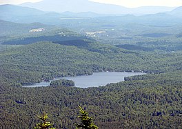
 Kiwassa Lake from Ampersand Mountain Kiwassa Lake from Ampersand Mountain | |
  | |
| Location | Adirondack Park, New York |
| Coordinates | 44°17′38″N 74°09′32″W / 44.294°N 74.159°W / 44.294; -74.159 |
| Primary outflows | Lake Oseetah |
| Basin countries | United States |
| Surface area | 280 acres (110 ha) |
| Surface elevation | 1,529 ft (466 m) |
Kiwassa Lake, originally called Lonesome Pond, is a 280-acre lake in the north-central Adirondack Park, south of Dewey Mountain, between Lower Saranac Lake and Oseetah Lake, two miles southwest of the village of Saranac Lake, New York, United States. It drains into Lake Oseetah, and thence into the Saranac River. The westernmost shore line is owned by New York State.
References
This article about a location in Franklin County, New York is a stub. You can help Misplaced Pages by expanding it. |