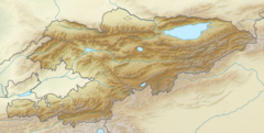
| Kojata | |
|---|---|
 | |
| Location | |
| Country | Kyrgyzstan |
| Physical characteristics | |
| Mouth | Kara-Suu |
| • coordinates | 41°39′50″N 72°02′57″E / 41.6638°N 72.0492°E / 41.6638; 72.0492 |
| Length | 18 km (11 mi) |
| Basin size | 280 km (110 sq mi) |
| Basin features | |
| Progression | Kara-Suu→ Naryn→ Syr Darya→ North Aral Sea |
The Kojata (Kyrgyz: Кожата) is a right tributary of the Kara-Suu in Jalal-Abad Region, Kyrgyzstan. Its source is in the Chatkal Range, western Tian Shan mountains, and is fed by the Toskool, which flows out of Lake Sary-Chelek. It is 18 km long and has a drainage basin of 280 km. It discharges into the Kara-Suu near Kyzyl-Tuu.
References
- "Кожата" [Kojata] (PDF). Кыргызстандын Географиясы (in Kyrgyz). Bishkek. 2004. p. 196.
{{cite encyclopedia}}: CS1 maint: location missing publisher (link) - Soviet military map K-43-19 (1:200,000)
This article related to a river in Kyrgyzstan is a stub. You can help Misplaced Pages by expanding it. |
This Jalal-Abad region location article is a stub. You can help Misplaced Pages by expanding it. |