Town in Victoria, Australia
| Kooloonong Victoria | |||||||||||||||
|---|---|---|---|---|---|---|---|---|---|---|---|---|---|---|---|
 | |||||||||||||||
| Coordinates | 34°52′S 143°08′E / 34.867°S 143.133°E / -34.867; 143.133 | ||||||||||||||
| Population | 39 (2016 census) | ||||||||||||||
| Postcode(s) | 3549 | ||||||||||||||
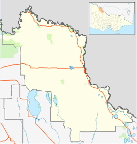
| Location | |||||||||||||||
| LGA(s) | Rural City of Swan Hill | ||||||||||||||
| Federal division(s) | Mallee | ||||||||||||||
| |||||||||||||||
Kooloonong is a locality in Victoria, Australia, located approximately 147 km from Mildura and was on the Yungera railway line.
Kooloonong was established as a soldier settlement area for returned servicemen from World War I. By the mid-1920s, it was a thriving township with a bush nursing hospital, government offices, a school, an RSL hall, a railway station and sporting facilities. The town has declined since then and now has only one occupied house, plus the rarely-used hall, a CFA shed and unused grain handling facilities.
The railway north of Swan Hill was extended from Piangil to Kooloonong in March 1920 to support the soldier settlement farms in the area. For many years, water was carted to the location by train because there was no natural water supply. The line from Piangil was closed in December 1986. Kooloonong Post Office opened around June 1920 and closed in 1973. It had a polling place for federal elections from 1922.
Yungera
In 1926, the railway to Kooloonong was further extended to a terminus named Yungera, at what is now the boundary between the localities of Kooloonong and Boundary Bend. The line was shortened back to Kooloonong in 1957. Yungera had a polling place for federal elections from 1929 to 1937.
References
- "2016 Kooloonong, Census All persons QuickStats | Australian Bureau of Statistics". abs.gov.au. Retrieved 25 May 2022.
- Travelmate Archived 24 March 2007 at the Wayback Machine
- Macfarlane, Neil (18 June 2015). "Submission to VEAC State Wide Assessment of Public Land" (PDF). Mid-Murray Field Naturalists Inc. Retrieved 1 January 2017.
- ^ "Kooloonong". Vicsig. Retrieved 15 March 2016.
- "No Water at Kooloonong". The Argus. 27 March 1923. Retrieved 15 March 2016.
- Phoenix Auctions History, Post Office List, retrieved 26 March 2021
- "APPOINTMENT OF ELECTORAL REGISTRARS AND POLLING PLACES CONSEQUENT ON PROCLAMATION OF DIVISIONS UNDER THE COMMONWEALTH ELECTORAL ACT 1918-1922". Commonwealth of Australia Gazette. Australia. 5 October 1922. p. 1733. Retrieved 20 January 2020 – via Trove.
- "Yungera". Victorian Railway Stations. 12 March 2012. Retrieved 1 January 2017.
- Sid Brown (March 1990). "Tracks Across the State". Newsrail. Australian Railway Historical Society (Victorian Division). pp. 71–76.
- "APPOINTMENT OF POLLING PLACES". Commonwealth of Australia Gazette. Australia. 20 June 1929. p. 1452. Retrieved 20 January 2020 – via Trove.
- "ABOLITION OF POLLING PLACES". Commonwealth of Australia Gazette. Australia. 21 January 1937. p. 77. Retrieved 20 January 2020 – via Trove.
| Localities in the Rural City of Swan Hill | ||
|---|---|---|
| City |  | |
| Town | ||
| Locality |
| |
| ^ - Territory divided with another LGA | ||