| Kosta | |
|---|---|
 Kosta glassworks, 1890s Kosta glassworks, 1890s | |
  | |
| Coordinates: 56°51′N 15°23′E / 56.850°N 15.383°E / 56.850; 15.383 | |
| Country | Sweden |
| Province | Småland |
| County | Kronoberg County |
| Municipality | Lessebo Municipality |
| Area | |
| • Total | 1.62 km (0.63 sq mi) |
| Population | |
| • Total | 884 |
| • Density | 547/km (1,420/sq mi) |
| Time zone | UTC+1 (CET) |
| • Summer (DST) | UTC+2 (CEST) |
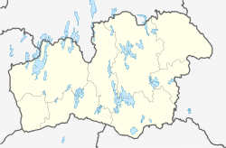
Kosta (Swedish pronunciation: [ˈkûːsta]) is a locality situated in Lessebo Municipality, Kronoberg County, Sweden with 884 inhabitants in 2010.
It is located between the cities of Kalmar and Växjö, in the forested Småland province.
Kosta is known for the glassworks, Kosta Boda.
Climate
| Climate data for Kosta Swedish Armed Forces Weather station, 1961-2020 | |||||||||||||
|---|---|---|---|---|---|---|---|---|---|---|---|---|---|
| Month | Jan | Feb | Mar | Apr | May | Jun | Jul | Aug | Sep | Oct | Nov | Dec | Year |
| Mean daily maximum °C (°F) | −1.1 (30.0) |
−0.4 (31.3) |
4.2 (39.6) |
10.0 (50.0) |
15.8 (60.4) |
19.0 (66.2) |
20.0 (68.0) |
19.4 (66.9) |
14.7 (58.5) |
10.2 (50.4) |
4.4 (39.9) |
1.0 (33.8) |
9.8 (49.6) |
| Daily mean °C (°F) | −3.4 (25.9) |
−3.4 (25.9) |
−0.4 (31.3) |
4.0 (39.2) |
9.8 (49.6) |
14.0 (57.2) |
15.2 (59.4) |
14.5 (58.1) |
10.6 (51.1) |
6.5 (43.7) |
1.8 (35.2) |
−1.8 (28.8) |
5.6 (42.1) |
| Mean daily minimum °C (°F) | −6.0 (21.2) |
−6.4 (20.5) |
−5.0 (23.0) |
−1.9 (28.6) |
3.7 (38.7) |
9.0 (48.2) |
10.0 (50.0) |
9.6 (49.3) |
5.5 (41.9) |
2.8 (37.0) |
−0.6 (30.9) |
−4.5 (23.9) |
1.3 (34.4) |
| Source: | |||||||||||||
References
- ^ "Tätorternas landareal, folkmängd och invånare per km 2005 och 2010" (in Swedish). Statistics Sweden. 14 December 2011. Archived from the original on 27 January 2012. Retrieved 10 January 2012.
- Jöran Sahlgren; Gösta Bergman (1979). Svenska ortnamn med uttalsuppgifter (in Swedish). p. 14.
- "SMHI". Archived from the original on 2013-02-13.
| Localities in Lessebo Municipality, Kronoberg County, Sweden | |
|---|---|
| Localities |
|