| Kraubath an der Mur | |
|---|---|
| Municipality | |
 View of Kraubath View of Kraubath | |
 Coat of arms Coat of arms | |
  | |
| Coordinates: 47°18′00″N 14°55′48″E / 47.30000°N 14.93000°E / 47.30000; 14.93000 | |
| Country | Austria |
| State | Styria |
| District | Leoben |
| Government | |
| • Mayor | Erich Ofner (ÖVP) |
| Area | |
| • Total | 27.44 km (10.59 sq mi) |
| Elevation | 632 m (2,073 ft) |
| Population | |
| • Total | 1,283 |
| • Density | 47/km (120/sq mi) |
| Time zone | UTC+1 (CET) |
| • Summer (DST) | UTC+2 (CEST) |
| Postal code | 8714 |
| Area code | 03832 |
| Vehicle registration | LN |
| Website | www.kraubath.at |
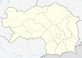
Kraubath an der Mur is a municipality in the district of Leoben in the Austrian state of Styria.
Name
The name of this place is mentioned many times in the 11th-13th century charters and it is written regularly as "Chrowat" which is toponym variant of name "Croat".
Geography
Kraubath an der Mur lies in the central Mur valley between Leoben and Knittelfeld.
References
- "Dauersiedlungsraum der Gemeinden Politischen Bezirke und Bundesländer - Gebietsstand 1.1.2018". Statistics Austria. Retrieved 10 March 2019.
- "Einwohnerzahl 1.1.2018 nach Gemeinden mit Status, Gebietsstand 1.1.2018". Statistics Austria. Retrieved 9 March 2019.
- Mate Božić; (2019) "Hrvat" i "Hrvati" – od toponima do etnonima ("Croat" and "Croats" - from toponyms to ethnonyms) p. 139; Pleter: Časopis udruge studenata povijesti, Vol. 3. No. 3
| Municipalities in the district of Leoben | |
|---|---|
This Styria location article is a stub. You can help Misplaced Pages by expanding it. |