Misplaced Pages

Krumbach, Swabia (district)

Article snapshot taken from Wikipedia with creative commons attribution-sharealike license. Give it a read and then ask your questions in the chat. We can research this topic together.
This article needs additional citations for verification. Please help improve this article by adding citations to reliable sources. Unsourced material may be challenged and removed.
Find sources: "Krumbach, Swabia" district – news · newspapers · books · scholar · JSTOR (September 2024) (Learn how and when to remove this message)
You can help expand this article with text translated from the corresponding article in German. (September 2024) Click for important translation instructions.
  • Machine translation, like DeepL or Google Translate, is a useful starting point for translations, but translators must revise errors as necessary and confirm that the translation is accurate, rather than simply copy-pasting machine-translated text into the English Misplaced Pages.
  • Consider adding a topic to this template: there are already 2,165 articles in the main category, and specifying|topic= will aid in categorization.
  • Do not translate text that appears unreliable or low-quality. If possible, verify the text with references provided in the foreign-language article.
  • You must provide copyright attribution in the edit summary accompanying your translation by providing an interlanguage link to the source of your translation. A model attribution edit summary is Content in this edit is translated from the existing German Misplaced Pages article at ]; see its history for attribution.
  • You may also add the template {{Translated|de|Landkreis Krumbach (Schwaben)}} to the talk page.
  • For more guidance, see Misplaced Pages:Translation.
District in Bavaria, Germany
Krumbach (Schwaben)
District
CountryGermany
StateBavaria
Adm. regionSwabia
Disbanded1 July 1972
CapitalKrumbach
Time zoneUTC+01:00 (CET)
 • Summer (DST)UTC+02:00 (CEST)
Vehicle registrationKRU
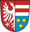
coat of arms
coat of arms

Krumbach was a district in Swabia, Bavaria, Germany, before the regional reorganization in 1972. Krumbach was the capital of this district. The licence plate code was KRU.

The district had 49 municipalities. The largest of them were the towns Krumbach, Bavaria and Thannhausen and the municipalities Ziemetshausen, Neuburg an der Kammel and Ursberg.

It was bounded by (from the north and clockwise) the districts of Günzburg, Augsburg, Schwabmünchen, Mindelheim, Illertissen and Neu-Ulm.

In 1972 the district was merged with Günzburg (district) and the urban district Günzburg to Günzburg district in today's borders.

Towns and municipalities of the district in the year 1970

The former district of Krumbach – numbers in the map: see also the opposite list

Towns
Krumbach
Thannhausen

Market Towns
Münsterhausen
Neuburg an der Kammel
Niederraunau, today: part of the town Krumbach
Ziemetshausen

Municipalities
1. Aichen
2. Aletshausen
3. Attenhausen, today: part of the town Krumbach
4. Balzhausen
5. Bayersried-Ursberg, today the name of the municipality is Ursberg
6. Behlingen, today: part of the municipality Kammeltal
7. Billenhausen, today: part of the town Krumbach
8 Breitenthal
9. Burg, today: part of the town Thannhausen
10. Deisenhausen
11. Ebershausen
12. Edelstetten, today: part of the market town Neuburg an der Kammel
13. Edenhausen, today: part of the town Krumbach

14. Ellzee
15. Hagenried, today: part of the market town Münsterhausen
16. Hairenbuch, today: part of the municipality Waltenhausen
17. Hasberg, today: part of the market town Kirchheim in Schwaben, which is part of Unterallgäu district
18. Haupeltshofen, today: part of the municipality Aletshausen
19. Hausen, today: part of the municipality Ellzee
20. Hohenraunau, today: part of the town Krumbach
21. Langenhaslach, today: part of the market town Neuburg an der Kammel
22. Lauterbach, today: part of the market town e Ziemetshausen
23. Memmenhausen, today: part of the municipality Aichen
24. Mindelzell, today: part of the municipality Ursberg
25. Muttershofen, today: part of the market town Ziemetshausen
26. Nattenhausen, today: part of the municipality Breitenthal
27. Oberbleichen, today: part of the municipality Deisenhausen
28. Oberegg, today: part of the municipality Wiesenbach
29. Obergessertshausen, today: part of the municipality Aichen

Unincorporated areas (Gemeindefreie Gebiete)
1. Buch
2. Ebershauser-Nattenhauser Wald]
3. Großer Buchwald
4. Lettenberg
5. Winzer Wald

30. Oberrohr, today: part of the municipality Ursberg
31. Oberwiesenbach, today: part of the municipality Wiesenbach
32. Premach, today: part of the municipality Ursberg
33. Ried, today: part of the municipality Kammeltal
34. Schellenbach (Vorder- and Hinterschellenbach), today: part of the market town Ziemetshausen
35. Seifertshofen, today: part of the municipality Ebershausen
36. Stoffenried, today: part of the municipality Ellzee
37. Tiefenried, today: part of the market town Kirchheim in Schwaben, which is part of Unterallgäu district
38. Unterbleichen, today: part of the municipality Deisenhausen
39. Unterwiesenbach, today: part of the municipality Wiesenbach
40. Waltenhausen
41. Wattenweiler, today: part of the market town Neuburg an der Kammel
42. Weiler, today: part of the municipality Waltenhausen
43. Winzer, today: part of the municipality Aletshausen

See also

References

  1. "Google Maps".

48°14′35″N 10°21′48″E / 48.2431°N 10.3633°E / 48.2431; 10.3633

Categories: