You can help expand this article with text translated from the corresponding article in Slovene. (December 2011) Click for important translation instructions.
|
| Kum | |
|---|---|
 The church and transmitter at the top of Kum The church and transmitter at the top of Kum | |
| Highest point | |
| Elevation | 1,220 m (4,000 ft) |
| Coordinates | 46°5′16.28″N 15°4′22.72″E / 46.0878556°N 15.0729778°E / 46.0878556; 15.0729778 |
| Geography | |
 | |
| Parent range | Sava Hills |
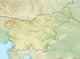
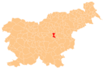
Kum (pronounced [ˈkuːm]; German: Kumberg) is the highest peak in the Slovenian Sava Hills. Its summit is at 1,220 meters (4,000 ft) above sea level. The mountain is also called the "Sava Triglav" (Slovene: Zasavski Triglav) because it is the highest peak in the region. There are a number of structures at the summit, notably a church dedicated to Saint Agnes from the 17th century and a transmitter. It belongs to the settlement of Ključevica.
Climate
| Climate data for Kum 1981-2010 (1218m) | |||||||||||||
|---|---|---|---|---|---|---|---|---|---|---|---|---|---|
| Month | Jan | Feb | Mar | Apr | May | Jun | Jul | Aug | Sep | Oct | Nov | Dec | Year |
| Mean daily maximum °C (°F) | −0.8 (30.6) |
0.5 (32.9) |
3.7 (38.7) |
8.3 (46.9) |
13.7 (56.7) |
16.6 (61.9) |
19.2 (66.6) |
18.9 (66.0) |
14.1 (57.4) |
9.7 (49.5) |
4.2 (39.6) |
0.8 (33.4) |
9.1 (48.3) |
| Daily mean °C (°F) | −2.9 (26.8) |
−2.9 (26.8) |
0.5 (32.9) |
4.5 (40.1) |
9.5 (49.1) |
12.7 (54.9) |
15.0 (59.0) |
14.7 (58.5) |
10.5 (50.9) |
6.6 (43.9) |
1.7 (35.1) |
−1.7 (28.9) |
5.7 (42.2) |
| Mean daily minimum °C (°F) | −5.3 (22.5) |
−5.7 (21.7) |
−2.4 (27.7) |
1.4 (34.5) |
6.4 (43.5) |
9.4 (48.9) |
11.5 (52.7) |
11.6 (52.9) |
8.0 (46.4) |
4.2 (39.6) |
−0.3 (31.5) |
−3.9 (25.0) |
2.9 (37.2) |
| Source: Slovenian Environment Agency (ARSO) | |||||||||||||
See also
References
- ^ Kum at hribi.net
- Leksikon občin kraljestev in dežel zastopanih v državnem zboru, vol. 6: Kranjsko. 1906. Vienna: C. Kr. Dvorna in Državna Tiskarna, p. 89. Archived 2013-06-05 at the Wayback Machine (in Slovene)
- "Kum Climate Normals 1981-2020" (PDF). ARSO. Retrieved 20 September 2023.
External links
 Media related to Kum at Wikimedia Commons
| Municipality of Trbovlje | ||||||
|---|---|---|---|---|---|---|
| Settlements | Administrative seat: Trbovlje
|  | ||||
| Landmarks | ||||||
| Notable people | ||||||
This Slovenian geography article is a stub. You can help Misplaced Pages by expanding it. |