You can help expand this article with text translated from the corresponding article in French. (December 2008) Click for important translation instructions.
|
| La Hoguette | |
|---|---|
| Commune | |
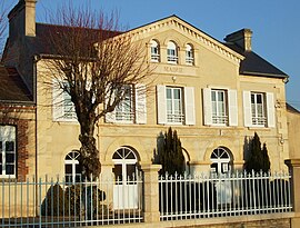
 Town hall Town hall | |
 Coat of arms Coat of arms | |
| Location of La Hoguette | |
  | |
| Coordinates: 48°52′42″N 0°09′32″W / 48.8783°N 0.1589°W / 48.8783; -0.1589 | |
| Country | France |
| Region | Normandy |
| Department | Calvados |
| Arrondissement | Caen |
| Canton | Falaise |
| Intercommunality | Pays de Falaise |
| Government | |
| • Mayor (2020–2026) | Sylvie Grenier |
| Area | 24.44 km (9.44 sq mi) |
| Population | 664 |
| • Density | 27/km (70/sq mi) |
| Time zone | UTC+01:00 (CET) |
| • Summer (DST) | UTC+02:00 (CEST) |
| INSEE/Postal code | 14332 /14700 |
| Elevation | 89–267 m (292–876 ft) (avg. 220 m or 720 ft) |
| French Land Register data, which excludes lakes, ponds, glaciers > 1 km (0.386 sq mi or 247 acres) and river estuaries. | |
La Hoguette (French pronunciation: [la ɔɡɛt] ) is a commune in the Calvados department in the Normandy region in northwestern France.
Geography
Five rivers run through the commune the Filaine, Gronde, Traine-feuilles, Trainefeuille and Bilaine.
| Neighbouring communes | ||||||||||||||||
|---|---|---|---|---|---|---|---|---|---|---|---|---|---|---|---|---|
| ||||||||||||||||
The Commune has an area of woods known as Saint-André.
Archeology
See also: Neolithic France, Neolithic Brittany, and Cortaillod culture
La Hoguette is also the type site of the early Neolithic La Hoguette culture that is found mainly in association with Linear pottery (Linearbandkeramic) or Limburg pottery in Northern France, The Netherlands, Alsace and Western Germany. It is believed to ultimately derive from the Mediterranean Cardial culture traditions. Important sites of the La-Hoguette culture include Stuttgart-Wilhelma, Dautenheim and Godelau.
The La Hoguette pottery was found under a later megalithic tomb and first misidentified as Linearbandkeramic. La Hoguette marks the westernmost point of the distribution of this culture. The place name La Hoguette is believed to derive from the Old Norse word Haugr meaning a knoll or a hill.
Population
| Year | Pop. | ±% p.a. |
|---|---|---|
| 1968 | 464 | — |
| 1975 | 436 | −0.89% |
| 1982 | 485 | +1.53% |
| 1990 | 532 | +1.16% |
| 1999 | 573 | +0.83% |
| 2009 | 678 | +1.70% |
| 2014 | 717 | +1.12% |
| 2020 | 664 | −1.27% |
| Source: INSEE | ||
Places of interest
Abbaye de Saint-André-de-Gouffern is the remains of a 12th century Abbey built in 1127 and is classed as a Monument historique
Personalities
La Hoguette was the birthplace of Georges Marchais (1920–1997), head of the French Communist Party.
See also
References
- "Répertoire national des élus: les maires" (in French). data.gouv.fr, Plateforme ouverte des données publiques françaises. 13 September 2022.
- "Populations de référence 2022" (in French). The National Institute of Statistics and Economic Studies. 19 December 2024.
- "La Hoguette · 14700, France". La Hoguette · 14700, France.
- "Bois de Saint-André forest(s), Basse-Normandie, France". fr.geoview.info.
- Twelve essential old Scandinavian words (old Norse) in placenames of Normandy (R. Lepelley. Caen University Archived 2011-07-21 at the Wayback Machine
- Population en historique depuis 1968, INSEE
- "Abbaye de Saint-André-de-Gouffern". www.pop.culture.gouv.fr.
- "Obituary: Georges Marchais". The Independent. 17 November 1997.
External links
- La Hoguette La Hoguette (M.O. Baldwin)
This Calvados geographical article is a stub. You can help Misplaced Pages by expanding it. |