| This article needs additional citations for verification. Please help improve this article by adding citations to reliable sources. Unsourced material may be challenged and removed. Find sources: "Lassing" – news · newspapers · books · scholar · JSTOR (April 2010) (Learn how and when to remove this message) |
| Lassing | |
|---|---|
| Municipality | |
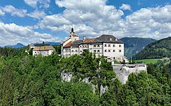
 Strechau Castle Strechau Castle | |
 Coat of arms Coat of arms | |
 | |
| Coordinates: 47°31′36″N 14°15′45″E / 47.52667°N 14.26250°E / 47.52667; 14.26250 | |
| Country | Austria |
| State | Styria |
| District | Liezen |
| Government | |
| • Mayor | Friedrich Stangl (ÖVP) |
| Area | |
| • Total | 37.15 km (14.34 sq mi) |
| Elevation | 782 m (2,566 ft) |
| Population | |
| • Total | 1,719 |
| • Density | 46/km (120/sq mi) |
| Time zone | UTC+1 (CET) |
| • Summer (DST) | UTC+2 (CEST) |
| Postal code | 8903 |
| Area code | 03612 |
| Vehicle registration | LI |
| Website | www.lassing.at |
Lassing (German: [ˈlasiŋ]) is a municipality in the district of Liezen, Styria, Austria.
On July 17, 1998, a local mine collapsed. One man survived but ten others perished.
Population
| Year | Pop. | ±% |
|---|---|---|
| 1869 | 1,950 | — |
| 1880 | 1,933 | −0.9% |
| 1890 | 1,709 | −11.6% |
| 1900 | 1,232 | −27.9% |
| 1910 | 1,185 | −3.8% |
| 1923 | 1,125 | −5.1% |
| 1934 | 1,272 | +13.1% |
| 1939 | 1,415 | +11.2% |
| 1951 | 1,542 | +9.0% |
| 1961 | 1,641 | +6.4% |
| 1971 | 1,662 | +1.3% |
| 1981 | 1,761 | +6.0% |
| 1991 | 1,910 | +8.5% |
| 2001 | 1,852 | −3.0% |
| 2011 | 1,703 | −8.0% |
References
- "Dauersiedlungsraum der Gemeinden Politischen Bezirke und Bundesländer - Gebietsstand 1.1.2018". Statistics Austria. Retrieved 10 March 2019.
- "Einwohnerzahl 1.1.2018 nach Gemeinden mit Status, Gebietsstand 1.1.2018". Statistics Austria. Retrieved 9 March 2019.
External links
| Municipalities in the district of Liezen | |
|---|---|
| Bereich Liezen | |
| Expositur Gröbming | |
This Styria location article is a stub. You can help Misplaced Pages by expanding it. |