| Leivi | |
|---|---|
| Comune | |
| Comune di Leivi | |
 | |
| Location of Leivi | |
  | |
| Coordinates: 44°21′N 9°19′E / 44.350°N 9.317°E / 44.350; 9.317 | |
| Country | Italy |
| Region | Liguria |
| Metropolitan city | Genoa (GE) |
| Frazioni | Bocco, Curlo, Mezzo, Rostio, San Bartolomeo, San Rufino di Leivi, Solaro (municipal seat) |
| Government | |
| • Mayor | Vittorio Centanaro |
| Area | |
| • Total | 9.71 km (3.75 sq mi) |
| Elevation | 118 m (387 ft) |
| Population | |
| • Total | 2,435 |
| • Density | 250/km (650/sq mi) |
| Demonym | Leivesi |
| Time zone | UTC+1 (CET) |
| • Summer (DST) | UTC+2 (CEST) |
| Postal code | 16040 |
| Dialing code | 0185 |
| Patron saint | St. John the Baptist |
| Saint day | 24 June |
| Website | Official website |
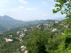
Leivi is a town and comune in the Metropolitan City of Genoa, in the Liguria region of northwest Italy.
Leivi sits in the Apennine hills, 6 kilometres (4 mi) from the town of Chiavari, overlooking the Gulf of Tigullio.
It is a centre for the production of olive oil.
References
- "Superficie di Comuni Province e Regioni italiane al 9 ottobre 2011". Italian National Institute of Statistics. Retrieved 16 March 2019.
- All demographics and other statistics: Italian statistical institute Istat.
- "B & B GLi Ulivi". Archived from the original on 2012-04-07. Retrieved 2012-03-17.
- Comune di Leivi http://www.comune.leivi.ge.it/cm/pages/ServeBLOB.php/L/IT/IDPagina/665
This Liguria location article is a stub. You can help Misplaced Pages by expanding it. |