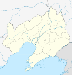
| Liaozhong 辽中区 | ||||||||||||||||||||||||||||||||||||||||||
|---|---|---|---|---|---|---|---|---|---|---|---|---|---|---|---|---|---|---|---|---|---|---|---|---|---|---|---|---|---|---|---|---|---|---|---|---|---|---|---|---|---|---|
| District | ||||||||||||||||||||||||||||||||||||||||||
 | ||||||||||||||||||||||||||||||||||||||||||
| Coordinates: 41°30′36″N 122°43′48″E / 41.510°N 122.730°E / 41.510; 122.730 | ||||||||||||||||||||||||||||||||||||||||||
| Country | People's Republic of China | |||||||||||||||||||||||||||||||||||||||||
| Province | Liaoning | |||||||||||||||||||||||||||||||||||||||||
| Sub-provincial city | Shenyang | |||||||||||||||||||||||||||||||||||||||||
| Area | ||||||||||||||||||||||||||||||||||||||||||
| • Total | 1,648 km (636 sq mi) | |||||||||||||||||||||||||||||||||||||||||
| Elevation | 16 m (53 ft) | |||||||||||||||||||||||||||||||||||||||||
| Population | ||||||||||||||||||||||||||||||||||||||||||
| • Total | 395,017 | |||||||||||||||||||||||||||||||||||||||||
| • Density | 240/km (620/sq mi) | |||||||||||||||||||||||||||||||||||||||||
| Time zone | UTC+8 (China Standard) | |||||||||||||||||||||||||||||||||||||||||
| Postal code | 1102XX | |||||||||||||||||||||||||||||||||||||||||
| Shenyang district map |
| |||||||||||||||||||||||||||||||||||||||||
Liaozhong District (simplified Chinese: 辽中区; traditional Chinese: 遼中區; pinyin: Liáozhōng Qū) is one of ten districts of the prefecture-level city of Shenyang, the capital of Liaoning Province, Northeast China. The name of the district literally means "Central Liao", referring to its central location within the province. It lies 67 km (42 mi) southwest of the downtown of Shenyang, near the intersection of G1 Beijing–Harbin Expressway and G91 Liaozhong Ring Expressway. As of 2020, it had a population of 395,017 residing in an area of 1,648 km (636 sq mi). It is the southernmost county-level division of Shenyang City, bordering Xinmin City to the north, and Tiexi District to the northeast, as well as the prefecture-level cities of Liaoyang to the southeast, Anshan to the south and southwest, and Jinzhou to the west.
Administrative divisions
There are 14 towns, and three townships within the district.
Towns:
|
|
Townships:
- Laodafang Township (老大房乡)*Daheigangzi Township (大黑岗子乡)*Niuxintuo Township (牛心坨乡)
Climate
| Climate data for Liaozhong (1991–2020 normals, extremes 1981–2010) | |||||||||||||
|---|---|---|---|---|---|---|---|---|---|---|---|---|---|
| Month | Jan | Feb | Mar | Apr | May | Jun | Jul | Aug | Sep | Oct | Nov | Dec | Year |
| Record high °C (°F) | 7.3 (45.1) |
17.3 (63.1) |
20.7 (69.3) |
29.1 (84.4) |
33.3 (91.9) |
36.2 (97.2) |
35.5 (95.9) |
35.0 (95.0) |
32.4 (90.3) |
28.8 (83.8) |
21.2 (70.2) |
12.7 (54.9) |
36.2 (97.2) |
| Mean daily maximum °C (°F) | −4.0 (24.8) |
0.8 (33.4) |
7.9 (46.2) |
17.2 (63.0) |
24.1 (75.4) |
27.4 (81.3) |
29.2 (84.6) |
28.7 (83.7) |
24.7 (76.5) |
16.8 (62.2) |
6.2 (43.2) |
−1.9 (28.6) |
14.8 (58.6) |
| Daily mean °C (°F) | −10.2 (13.6) |
−5.4 (22.3) |
1.9 (35.4) |
10.7 (51.3) |
17.9 (64.2) |
22.2 (72.0) |
24.7 (76.5) |
23.7 (74.7) |
18.1 (64.6) |
10.3 (50.5) |
0.7 (33.3) |
−7.6 (18.3) |
8.9 (48.1) |
| Mean daily minimum °C (°F) | −15.6 (3.9) |
−10.9 (12.4) |
−3.5 (25.7) |
4.6 (40.3) |
12.0 (53.6) |
17.4 (63.3) |
20.8 (69.4) |
19.5 (67.1) |
12.6 (54.7) |
4.6 (40.3) |
−4.1 (24.6) |
−12.6 (9.3) |
3.7 (38.7) |
| Record low °C (°F) | −33.7 (−28.7) |
−30.1 (−22.2) |
−16.9 (1.6) |
−14.69 (5.56) |
0.1 (32.2) |
6.6 (43.9) |
13.2 (55.8) |
6.8 (44.2) |
0.6 (33.1) |
−7.1 (19.2) |
−23.2 (−9.8) |
−27.5 (−17.5) |
−33.7 (−28.7) |
| Average precipitation mm (inches) | 3.6 (0.14) |
6.1 (0.24) |
12.9 (0.51) |
31.0 (1.22) |
57.8 (2.28) |
79.9 (3.15) |
175.9 (6.93) |
137.2 (5.40) |
55.1 (2.17) |
42.0 (1.65) |
18.1 (0.71) |
7.2 (0.28) |
626.8 (24.68) |
| Average precipitation days (≥ 0.1 mm) | 2.3 | 2.5 | 3.7 | 5.7 | 8.6 | 11.2 | 10.3 | 10.0 | 6.4 | 6.0 | 4.5 | 2.8 | 74 |
| Average snowy days | 3.5 | 3.2 | 3.0 | 0.8 | 0 | 0 | 0 | 0 | 0 | 0.4 | 3.3 | 4.0 | 18.2 |
| Average relative humidity (%) | 60 | 55 | 53 | 51 | 56 | 70 | 81 | 82 | 74 | 66 | 63 | 63 | 65 |
| Mean monthly sunshine hours | 193.2 | 199.0 | 235.5 | 233.2 | 260.9 | 230.1 | 205.2 | 217.6 | 233.7 | 213.3 | 173.1 | 173.3 | 2,568.1 |
| Percent possible sunshine | 65 | 66 | 63 | 58 | 58 | 51 | 45 | 52 | 63 | 63 | 59 | 61 | 59 |
| Source: China Meteorological Administration | |||||||||||||
References
- "Liaozhong" (Map). Google Maps. Retrieved 2014-07-02.
- 分地区土地面积和人口密度 (2012年末) (in Chinese). Shenyang Statistics Bureau. Archived from the original on 26 September 2018. Retrieved 6 July 2014.
- "China: Liáoníng (Prefectures, Cities, Districts and Counties) – Population Statistics, Charts and Map".
- 2011年统计用区划代码和城乡划分代码:辽中县 (in Chinese). National Bureau of Statistics of the People's Republic of China. Archived from the original on 2012-12-08. Retrieved 2012-07-17.
- 中国气象数据网 – WeatherBk Data (in Simplified Chinese). China Meteorological Administration. Retrieved 29 July 2023.
- 中国气象数据网 (in Simplified Chinese). China Meteorological Administration. Retrieved 29 July 2023.
External links
This Liaoning location article is a stub. You can help Misplaced Pages by expanding it. |
