| Lisina | |
|---|---|
 | |
| Highest point | |
| Elevation | 1.467 m (4 ft 9.8 in) |
| Coordinates | 44°23′51″N 17°02′31″E / 44.397390°N 17.041971°E / 44.397390; 17.041971 |
| Geography | |
| Location | Bosnia and Herzegovina |
| Municipalities | Mrkonjić Grad and Šipovo |
| Town | Mrkonjić Grad |
| Parent range | Dinaric Alps |
| Geology | |
| Mountain type | Igneous |
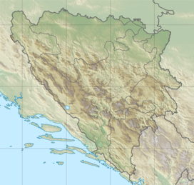
Lisina is a mountain of volcanic origin, located between the Municipality of Mrkonjić Grad and the Municipality of Šipovo, Bosnia and Herzegovina. Its highest peak, Bandira, is at a height of 1.467 m (4 ft 9.8 in).
Thanks to its geological structure, it is characterized by the great biodiversity of plant and animal species. More than 1,000 plant species, about 1,500 species of mushrooms, with particularly abundant truffles occurrence, five species of fish inhabiting mountain streams and Balkana Lakes, about ten species of amphibians and reptiles, 29 species of mammals and 107 bird species have been discovered and described in previous studies. About 360 sources (mountain springs) of drinking water were found on and around mountain, which represent significant water resources in the local area.
On its top there is a mountain lodge, Planinarski Dom "Lisina", and on the slopes of the mountain there are several villages of Mrkonjič municipality. At the foothills of Lisina, near the village of Podrašnica, there is a picnic and recreation resort, Eco Zone "Zelenkovac".
References
- "Lisina dragulj prirode". Retrieved 13 October 2010.
- „Turistički vodič Mrkonjić Grada“, Udruženje za razvoj i unapređenje turizma opštine Mrkonjić Grad, 2010.