Map all coordinates using OpenStreetMap
Download coordinates as:
This list is of the Cultural Properties of Japan designated in the category of paintings (絵画, kaiga) for the Prefecture of Fukushima.
National Cultural Properties
As of 1 July 2020, five Important Cultural Properties have been designated, being of national significance.
| Property | Date | Municipality | Ownership | Comments | Image | Dimensions | Coordinates | Ref. |
|---|---|---|---|---|---|---|---|---|
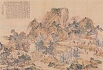
| Descent of Amida with Twenty-Five Bodhisattvas, colour on silk 絹本著色阿弥陀二十五菩薩来迎図 kenpon chakushoku Amida nijūgo bosatsu raigō zu |
Kamakura period | Aizuwakamatsu | Fukushima Museum |  |
37°29′20″N 139°56′05″E / 37.488761°N 139.934621°E / 37.488761; 139.934621 (Fukushima Museum) | |||
| Miroku, colour on silk 絹本著色弥勒菩薩像 kenpon chakushoku Miroku bosatsu zō |
C13 | Iwaki | Yakuōji (薬王寺) |  |
155 centimetres (61 in) by 58.8 centimetres (23.1 in) | 37°06′57″N 140°55′07″E / 37.115769°N 140.918643°E / 37.115769; 140.918643 (Yakuōji) | ||
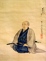
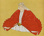
| Gamō Ujisato, colour on paper 紙本著色蒲生氏郷像 shihon chakushoku Gamō Ujisato zō |
1621 | Aizuwakamatsu | Saikōji (西光寺) (kept at Fukushima Museum) |
 |
37°29′20″N 139°56′05″E / 37.488761°N 139.934621°E / 37.488761; 139.934621 (Fukushima Museum) | |||
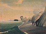
| Famous Places in the Eastern Capital, copperplates by Aōdō Denzen 銅版画東都名所図〈亜欧堂田善筆/(二十五図)〉 dōhanga tōto meisho zu |
1748–1822 | Sukagawa | Sukagawa City Museum (須賀川市立博物館) | series of twenty-five prints; the designation includes a sample book |  |
37°17′29″N 140°22′45″E / 37.291382°N 140.379170°E / 37.291382; 140.379170 (Sukagawa City Museum) | ||
| Amida Triad, colour on silk 絹本著色阿弥陀三尊像 kenpon chakushoku Amida sanzon zō |
C13 | Taitō, Tokyo | Iwaki City (kept at the Tokyo National Museum) |
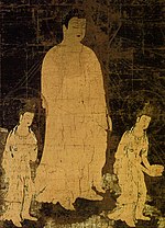 |
323.5 centimetres (127.4 in) by 166.8 centimetres (65.7 in) | 35°43′08″N 139°46′35″E / 35.718817°N 139.776478°E / 35.718817; 139.776478 (Tokyo National Museum) |
Prefectural Cultural Properties
As of 18 February 2020, twenty-seven properties have been designated at a prefectural level.
| Cultural Properties of Japan - paintings | ||
|---|---|---|
| Hokkaidō |  | |
| Tōhoku | ||
| Kantō | ||
| Chūbu | ||
| Kansai | ||
| Chūgoku | ||
| Shikoku | ||
| Kyūshū | ||
| Okinawa | ||
See also
- Cultural Properties of Japan
- List of National Treasures of Japan (paintings)
- Japanese painting
- List of Historic Sites of Japan (Fukushima)
- List of Places of Scenic Beauty of Japan (Fukushima)
References
- "Cultural Properties for Future Generations". Agency for Cultural Affairs. Retrieved 9 July 2020.
- 国宝・重要文化財 [Number of National Treasures and Important Cultural Properties by Prefecture] (in Japanese). Agency for Cultural Affairs. 1 July 2020. Retrieved 9 July 2020.
- "Database of National Cultural Properties: 国宝・重要文化財(美術品)(絵画 福島県)" (in Japanese). Agency for Cultural Affairs. Retrieved 9 July 2020.
- ^ 国指定(登録・選定・選択)・県指定(選定)文化財地域別件数 [Number of National and Prefectural Cultural Properties] (PDF) (in Japanese). Fukushima Prefecture. 18 February 2020. Retrieved 9 July 2020.
- 銅版画見本帖〈亜欧堂田善筆/(十二図)〉 [Copperplate sample book] (in Japanese). Agency for Cultural Affairs. Retrieved 26 July 2014.
External links
- (in Japanese) Cultural Properties in Fukushima Prefecture
