Misplaced Pages

List of Indiana state historical markers in Clark County

Article snapshot taken from Wikipedia with creative commons attribution-sharealike license. Give it a read and then ask your questions in the chat. We can research this topic together.


Location of Clark County in Indiana

This is a list of the Indiana state historical markers in Clark County.

This is intended to be a complete list of the official state historical markers placed in Clark County, Indiana, United States by the Indiana Historical Bureau. The locations of the historical markers and their latitude and longitude coordinates are included below when available, along with their names, years of placement, and topics as recorded by the Historical Bureau. There are 17 historical markers located in Clark County.

Map all coordinates using OpenStreetMap

Download coordinates as:

Historical markers

Marker title Image Year placed Location Topics
Clarksville 1940s Junction of Clark Boulevard and Harrison Avenue on a landscaped median in Clarksville
38°17′12″N 85°45′47.4″W / 38.28667°N 85.763167°W / 38.28667; -85.763167 (Clarksville)
Early Settlement and Exploration, Historic District, Neighborhoods, and Towns
Civil War Hospital 1962 Northeastern lawn of 301 Park Place at Crestview, at the Holt Masonic Orphan's Home in the Port Fulton neighborhood of Jeffersonville
38°16′56″N 85°43′16″W / 38.28222°N 85.72111°W / 38.28222; -85.72111 (Civil War Hospital)
Science, Medicine, and Inventions, Military
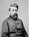
General Jefferson C. Davis 1828-1879 1963 Junction of U.S. Route 31 and Court Street in Memphis
38°29′0″N 85°45′46.6″W / 38.48333°N 85.762944°W / 38.48333; -85.762944 (General Jefferson C. Davis 1828-1879)
Military
Grave of Jonathan Jennings 1784-1834 (two blocks east) 1966 Market Street/State Road 3 at Pleasant Street in Charlestown
38°26′46″N 85°39′53″W / 38.44611°N 85.66472°W / 38.44611; -85.66472 (Grave of Jonathan Jennings 1784-1834 (two blocks east))
Politics
Birthplace and Childhood Home of Col. Harland Sanders 1987 Southern side of State Road 160 at Exit 16 from northbound Interstate 65 at Henryville
38°32′24″N 85°46′34″W / 38.54000°N 85.77611°W / 38.54000; -85.77611 (Birthplace and Childhood Home of Col. Harland Sanders)
Business, Industry, and Labor
Lewis and Clark Expedition 1803-1806 1991 Falls of the Ohio State Park near the George Rogers Clark Homesite at 1200 S. Harrison Street in Clarksville
38°17′13″N 85°46′34″W / 38.28694°N 85.77611°W / 38.28694; -85.77611 (Lewis and Clark Expedition 1803-1806)
Early Settlement and Exploration
Clark State Forest 1992 U.S. Route 31 within Clark State Forest, 100 yards past the entrance on the southern side of a forest road north of Henryville
38°33′11″N 85°46′0″W / 38.55306°N 85.76667°W / 38.55306; -85.76667 (Clark State Forest)
Nature and Natural Disasters, Science, Medicine, and Inventions
Borden Institute Site 1995 301 West Street at a school drive, near Borden and New Providence
38°28′10″N 85°56′48″W / 38.46944°N 85.94667°W / 38.46944; -85.94667 (Borden Institute Site)
Education, Agriculture
Fern Grove and Rose Island Resorts 1998 State Road 62 at the entrance to Charlestown State Park near Charlestown
38°26′58″N 85°38′45″W / 38.44944°N 85.64583°W / 38.44944; -85.64583 (Fern Grove and Rose Island Resorts)
Arts and Culture, Nature and Natural Disasters, Military
Tunnel Mill 2001 3709 Tunnel Mill Road near Charlestown
38°28′54″N 85°37′34″W / 38.48167°N 85.62611°W / 38.48167; -85.62611 (Tunnel Mill)
Business, Industry, and Labor, Nature and Natural Disasters
Indiana State Prison 2006 1400 block of S. Clark Boulevard in Clarksville
38°16′28.2″N 85°45′8″W / 38.274500°N 85.75222°W / 38.274500; -85.75222 (Indiana State Prison)
Government Institutions, Buildings and Architecture, Women
Hannah Toliver 2008 Junction of Pearl Street and Riverside Drive in Jeffersonville
38°16′8″N 85°44′23″W / 38.26889°N 85.73972°W / 38.26889; -85.73972 (Hannah Toliver)
John Work Home and Mill 2012 3709 Tunnel Mill Road, Charlestown
38°28′52″N 85°37′32″W / 38.48111°N 85.62556°W / 38.48111; -85.62556 (John Work House and Mill Marker)
Early Settlement; Business, Industry and Labor; Buildings and Architecture
WWII Army Ammunition Plant 2017 Along Corporate Drive, just southeast of the River Ridge Development Authority at 300 Corporate Drive, Utica Business, Industry, and Labor; Military; Buildings and Architecture
Sterilization & Eugenics 2017 1410 S Clark Blvd, Clarksville
Mary Garrett Hay 2021 Charlestown City Square, intersection of Main St. and Short St., Charlestown
"Colonel" Harland Sanders 2022 Across the street from 6012 Zollman Rd., Henryville
38°32′48″N 85°42′37″W / 38.54667°N 85.71028°W / 38.54667; -85.71028 (Colonel Harland Sanders Marker)
Business, Industry, & Labor

See also

References

  1. "Indiana Historical Markers by County". State of Indiana. Retrieved 2012-03-15.
  2. Clarksville, Indiana Historical Bureau, n.d. Accessed 2012-03-14.
  3. Civil War Hospital, Indiana Historical Bureau, n.d. Accessed 2012-03-14.
  4. General Jefferson C. Davis 1828-1879, Indiana Historical Bureau, n.d. Accessed 2012-03-14.
  5. Grave of Jonathan Jennings 1784-1834 (two blocks east), Indiana Historical Bureau, n.d. Accessed 2012-03-14.
  6. Birthplace and Childhood Home of Col. Harland Sanders, Indiana Historical Bureau, n.d. Accessed 2012-03-14.
  7. Lewis and Clark Expedition 1803-1806, Indiana Historical Bureau, n.d. Accessed 2012-03-14.
  8. Clark State Forest, Indiana Historical Bureau, n.d. Accessed 2012-03-14.
  9. Borden Institute Site, Indiana Historical Bureau, n.d. Accessed 2012-03-14.
  10. Fern Grove and Rose Island Resorts, Indiana Historical Bureau, n.d. Accessed 2012-03-14.
  11. Tunnel Mill, Indiana Historical Bureau, n.d. Accessed 2012-03-14.
  12. Indiana State Prison, Indiana Historical Bureau, n.d. Accessed 2012-03-14.
  13. Hannah Toliver, Indiana Historical Bureau, n.d. Accessed 2012-03-14.
  14. IHB (2020-12-15). "John Work Home and Mill". IHB. Retrieved 2024-03-13.
  15. IHB (2020-12-15). "WWII Army Ammunition Plant". IHB. Retrieved 2024-03-13.
  16. IHB (2020-12-15). "Sterilization & Eugenics". IHB. Retrieved 2024-03-13.
  17. IHB (2021-11-16). "Mary Garrett Hay, ca. 1857-1928". IHB. Retrieved 2024-03-13.
  18. IHB (2022-09-22). "IHB: "Colonel" Harland Sanders". IHB. Retrieved 2024-03-13.

External links

Municipalities and communities of Clark County, Indiana, United States
County seat: Jeffersonville
Cities
Map of Indiana highlighting Clark County
Towns
Townships
CDPs
Other
communities
Footnotes‡This populated place also has portions in an adjacent county or counties
Categories: