Misplaced Pages

List of beaches in Saint Lucia

Article snapshot taken from Wikipedia with creative commons attribution-sharealike license. Give it a read and then ask your questions in the chat. We can research this topic together.
Beaches in Saint Lucia
This article has multiple issues. Please help improve it or discuss these issues on the talk page. (Learn how and when to remove these messages)
Some of this article's listed sources may not be reliable. Please help improve this article by looking for better, more reliable sources. Unreliable citations may be challenged and removed. (September 2021) (Learn how and when to remove this message)
The topic of this article may not meet Misplaced Pages's notability guideline for stand-alone lists. Please help to demonstrate the notability of the topic by citing reliable secondary sources that are independent of the topic and provide significant coverage of it beyond a mere trivial mention. If notability cannot be shown, the article is likely to be merged, redirected, or deleted.
Find sources: "List of beaches in Saint Lucia" – news · newspapers · books · scholar · JSTOR (November 2021) (Learn how and when to remove this message)
(Learn how and when to remove this message)

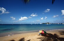
Saint Lucia is known for beaches some of which are covered in black volcanic sand. The island's temperature averages 27 °C (80 °F) all year. The island offers many water adventures, everything from snorkelling to jet skiing to parasailing.

Beaches

Map all coordinates using OpenStreetMap

Download coordinates as:

The following are some of the most popular and well known beaches in the island nation of Saint Lucia:

Beaches in Saint Lucia
Beach Location District Coordinates Refs
Anse Chastanet beach Anse Chastanet Cove Soufrière District 13°51′54″N 61°04′44″W / 13.86489°N 61.07878°W / 13.86489; -61.07878 (Anse Chastanet Cove)
Anse Cochon Beach Cochon Bay Canaries District 13°55′39″N 61°03′29″W / 13.92748°N 61.05816°W / 13.92748; -61.05816 (Anse Cochon Beach)
Anse de Sables Beach (Sandy Beach) Anse de Sables Vieux Fort District 13°43′24″N 60°56′32″W / 13.72325°N 60.94223°W / 13.72325; -60.94223 (Anse de Sables Beach)
Anse Louvet beach Anse Louvet Bay Dennery District 13°57′47″N 60°52′39″W / 13.96319°N 60.87747°W / 13.96319; -60.87747 (Anse Louvet Bay)
Anse Mamin Beach Anse Mamin Soufrière District 13°52′14″N 61°04′46″W / 13.87063°N 61.07952°W / 13.87063; -61.07952 (Anse Mamin Beach)
Choc Beach Choc Bay Castries District 14°01′58″N 60°58′33″W / 14.03282°N 60.97574°W / 14.03282; -60.97574 (Choc Beach)
Grande Anse beach Grande Anse Gros Islet District 14°00′26″N 60°53′07″W / 14.00721°N 60.88522°W / 14.00721; -60.88522 (Grande Anse)
Honeymoon Beach L'Islet Point Micoud District 13°46′27″N 60°54′08″W / 13.77425°N 60.90232°W / 13.77425; -60.90232 (Honeymoon Beach)
Kiwanies Beach Choc Bay Castries District 14°01′18″N 60°59′29″W / 14.02171°N 60.99135°W / 14.02171; -60.99135 (Kiwanies Beach)
Laborie Beach Laborie Bay Laborie District 13°44′56″N 61°00′05″W / 13.74879°N 61.00141°W / 13.74879; -61.00141 (Laborie Bay)
Malibar Beach Choc Bay Gros Islet District 14°01′33″N 60°59′00″W / 14.02579°N 60.98326°W / 14.02579; -60.98326 (Malibar Beach)
Marigot Bay Marigot Point Castries District 13°58′13″N 61°01′45″W / 13.97031°N 61.02909°W / 13.97031; -61.02909 (Marigot Point)
Marisule Beach Choc Bay Gros Islet District 14°02′51″N 60°58′19″W / 14.04748°N 60.97188°W / 14.04748; -60.97188 (Marisule Beach)
Pigeon Island beach Pigeon Island Gros Islet District 14°05′30″N 60°57′34″W / 14.091578323610506°N 60.95943519682145°W / 14.091578323610506; -60.95943519682145 (Pigeon Island)
La Pointe Beach La Pointe Choiseul District 13°47′23″N 61°04′03″W / 13.78971°N 61.06752°W / 13.78971; -61.06752 (La Pointe Beach)
Reduit Beach Rodney Bay Gros Islet District 14°04′31″N 60°57′19″W / 14.07523°N 60.95527°W / 14.07523; -60.95527 (Reduit Beach)
La Toc Beach La Toc Bay Castries District 14°00′41″N 61°00′34″W / 14.01132°N 61.00953°W / 14.01132; -61.00953 (La Toc Bay)
Vigie Beach Choc Bay, near George F. L. Charles Airport Castries District 14°01′29″N 60°59′05″W / 14.0247°N 60.98465°W / 14.0247; -60.98465 (Vigie Beach)
Yellow Sands Beach La Toc Bay Castries District 14°00′33″N 61°00′32″W / 14.00914°N 61.00882°W / 14.00914; -61.00882 (Yellow Sands Beach)
Vigie Beach
Reduit Beach
Anse Chastanet Beach

See also

References

  1. McCoy, John (2003). "Saint Lucia". Geo-data : the world geographical encyclopedia (Third ed.). Detroit, Michigan: Gale. pp. 462–464. ISBN 9780787677084.
  2. "Things to do in Saint Lucia". US News. Retrieved August 29, 2021.
  3. "St Lucia beaches". Celebrity Cruises. 10 February 2021. Retrieved August 29, 2021.
  4. "St. Lucia beaches". GeoNames. Retrieved August 29, 2021.
  5. "Anse Chastanet Cove". GeoName. Retrieved September 1, 2021.
  6. ^ "Our Island". Saint Lucia Tourism. Retrieved September 10, 2021.
  7. "Anse Cochon". GeoNames. Retrieved September 1, 2021.
  8. "Anse de Sables". GeoNames. Retrieved September 1, 2021.
  9. "Anse Louvet Bay". GeoNames. Retrieved September 1, 2021.
  10. "Anse Mamin". GeoNames. Retrieved September 1, 2021.
  11. "Choc Beach". GeoNames. Retrieved September 1, 2021.
  12. "Grande Anse". GeoNames. Retrieved September 1, 2021.
  13. "L'Islet Point Beach". GeoNames. Retrieved September 10, 2021.
  14. "Kiwanies Beach". GeoNames. Retrieved September 1, 2021.
  15. "Laborie Bay". GeoNames. Retrieved September 1, 2021.
  16. "Malibar Beach". GeoNames. Retrieved September 1, 2021.
  17. "Mairgot Point". GeoNames. Retrieved September 1, 2021.
  18. "Marisule Beach". GeoName. Retrieved September 1, 2021.
  19. "Pigeon Island". GeoName. Retrieved September 1, 2021.
  20. "La Pointe Beach". GeoName. Retrieved September 1, 2021.
  21. "Reduit Beach". GeoName. Retrieved September 1, 2021.
  22. "La Toc Bay". GeoName. Retrieved September 1, 2021.
  23. "Vigie Beach". GeoNames. Retrieved September 1, 2021.
  24. "Yellow Sands Beach". GeoNames. Retrieved September 1, 2021.
Categories: